You are here: Home > Network List > IU - Global Seismograph Network (GSN - IRIS/USGS) Stations List
> Station CCM Cathedral Cave, Missouri, USA > Earthquake Result Viewer
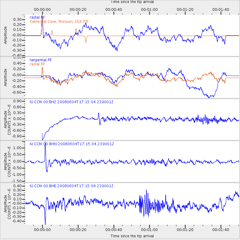
CCM Cathedral Cave, Missouri, USA - Earthquake Result Viewer
*The percent match for this event was below the threshold and hence no stack was calculated.
| Earthquake location: |
Hokkaido, Japan Region |
| Earthquake latitude/longitude: |
41.5/139.0 |
| Earthquake time(UTC): |
2008/06/04 (156) 17:03:07 GMT |
| Earthquake Depth: |
213 km |
| Earthquake Magnitude: |
5.5 MB, 5.7 MW, 5.7 MW |
| Earthquake Catalog/Contributor: |
WHDF/NEIC |
|
| Network: |
IU Global Seismograph Network (GSN - IRIS/USGS) |
| Station: |
CCM Cathedral Cave, Missouri, USA |
| Lat/Lon: |
38.06 N/91.24 W |
| Elevation: |
222 m |
|
| Distance: |
88.5 deg |
| Az: |
37.411 deg |
| Baz: |
324.705 deg |
| Ray Param: |
$rayparam |
*The percent match for this event was below the threshold and hence was not used in the summary stack. |
|
| Radial Match: |
22.543192 % |
| Radial Bump: |
400 |
| Transverse Match: |
18.289446 % |
| Transverse Bump: |
400 |
| SOD ConfigId: |
2504 |
| Insert Time: |
2010-03-04 15:48:36.565 +0000 |
| GWidth: |
2.5 |
| Max Bumps: |
400 |
| Tol: |
0.001 |
|
Signal To Noise
| Channel | StoN | STA | LTA |
| IU:CCM:00:BHN:20080604T17:15:04.239001Z | 10.123664 | 4.6894283E-7 | 4.6321453E-8 |
| IU:CCM:00:BHE:20080604T17:15:04.239001Z | 1.4769773 | 1.3930834E-7 | 9.4319894E-8 |
| IU:CCM:00:BHZ:20080604T17:15:04.239001Z | 0.67075276 | 2.0781177E-7 | 3.0981874E-7 |
| Arrivals |
| Ps | |
| PpPs | |
| PsPs/PpSs | |


