You are here: Home > Network List > IU - Global Seismograph Network (GSN - IRIS/USGS) Stations List
> Station CCM Cathedral Cave, Missouri, USA > Earthquake Result Viewer
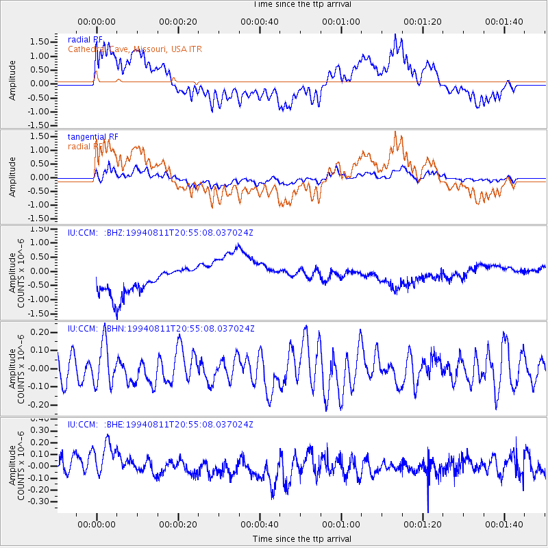
CCM Cathedral Cave, Missouri, USA - Earthquake Result Viewer
*The percent match for this event was below the threshold and hence no stack was calculated.
| Earthquake location: |
Tonga Islands |
| Earthquake latitude/longitude: |
-21.5/-173.8 |
| Earthquake time(UTC): |
1994/08/11 (223) 20:42:09 GMT |
| Earthquake Depth: |
33 km |
| Earthquake Magnitude: |
5.8 MB, 5.5 MS, 5.8 UNKNOWN |
| Earthquake Catalog/Contributor: |
WHDF/NEIC |
|
| Network: |
IU Global Seismograph Network (GSN - IRIS/USGS) |
| Station: |
CCM Cathedral Cave, Missouri, USA |
| Lat/Lon: |
38.06 N/91.24 W |
| Elevation: |
222 m |
|
| Distance: |
97.4 deg |
| Az: |
52.128 deg |
| Baz: |
248.62 deg |
| Ray Param: |
$rayparam |
*The percent match for this event was below the threshold and hence was not used in the summary stack. |
|
| Radial Match: |
35.832077 % |
| Radial Bump: |
400 |
| Transverse Match: |
39.11299 % |
| Transverse Bump: |
400 |
| SOD ConfigId: |
4480 |
| Insert Time: |
2010-03-04 15:48:54.622 +0000 |
| GWidth: |
2.5 |
| Max Bumps: |
400 |
| Tol: |
0.001 |
|
Signal To Noise
| Channel | StoN | STA | LTA |
| IU:CCM: :BHN:19940811T20:55:08.037024Z | 1.3221625 | 1.1861528E-7 | 8.971309E-8 |
| IU:CCM: :BHE:19940811T20:55:08.037024Z | 1.5103512 | 2.3216163E-7 | 1.5371367E-7 |
| IU:CCM: :BHZ:19940811T20:55:08.037024Z | 2.4406927 | 1.02403E-6 | 4.195653E-7 |
| Arrivals |
| Ps | |
| PpPs | |
| PsPs/PpSs | |


