You are here: Home > Network List > IU - Global Seismograph Network (GSN - IRIS/USGS) Stations List
> Station CCM Cathedral Cave, Missouri, USA > Earthquake Result Viewer
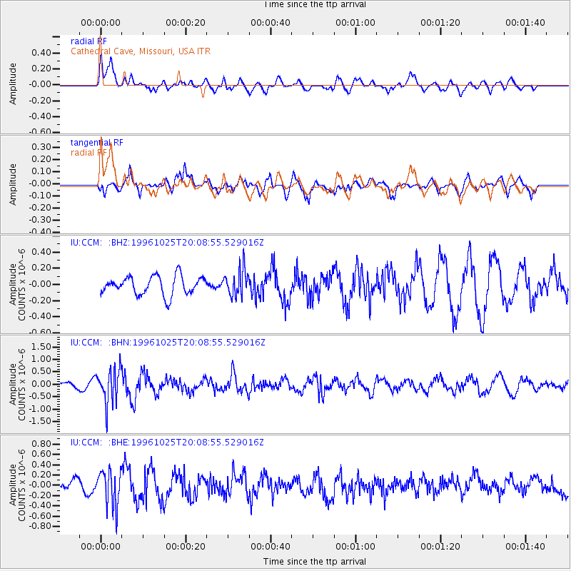
CCM Cathedral Cave, Missouri, USA - Earthquake Result Viewer
*The percent match for this event was below the threshold and hence no stack was calculated.
| Earthquake location: |
Peru-Bolivia Border Region |
| Earthquake latitude/longitude: |
-17.4/-70.0 |
| Earthquake time(UTC): |
1996/10/25 (299) 19:59:41 GMT |
| Earthquake Depth: |
116 km |
| Earthquake Magnitude: |
5.5 MB, 5.7 UNKNOWN, 5.6 MW |
| Earthquake Catalog/Contributor: |
WHDF/NEIC |
|
| Network: |
IU Global Seismograph Network (GSN - IRIS/USGS) |
| Station: |
CCM Cathedral Cave, Missouri, USA |
| Lat/Lon: |
38.06 N/91.24 W |
| Elevation: |
222 m |
|
| Distance: |
58.6 deg |
| Az: |
340.42 deg |
| Baz: |
156.085 deg |
| Ray Param: |
$rayparam |
*The percent match for this event was below the threshold and hence was not used in the summary stack. |
|
| Radial Match: |
70.57429 % |
| Radial Bump: |
400 |
| Transverse Match: |
67.1403 % |
| Transverse Bump: |
400 |
| SOD ConfigId: |
4480 |
| Insert Time: |
2010-03-04 15:48:59.090 +0000 |
| GWidth: |
2.5 |
| Max Bumps: |
400 |
| Tol: |
0.001 |
|
Signal To Noise
| Channel | StoN | STA | LTA |
| IU:CCM: :BHN:19961025T20:08:55.529016Z | 4.011621 | 6.7497234E-7 | 1.6825426E-7 |
| IU:CCM: :BHE:19961025T20:08:55.529016Z | 3.0965111 | 3.4944904E-7 | 1.12852504E-7 |
| IU:CCM: :BHZ:19961025T20:08:55.529016Z | 1.4199736 | 1.6277727E-7 | 1.1463401E-7 |
| Arrivals |
| Ps | |
| PpPs | |
| PsPs/PpSs | |


