You are here: Home > Network List > IU - Global Seismograph Network (GSN - IRIS/USGS) Stations List
> Station CCM Cathedral Cave, Missouri, USA > Earthquake Result Viewer
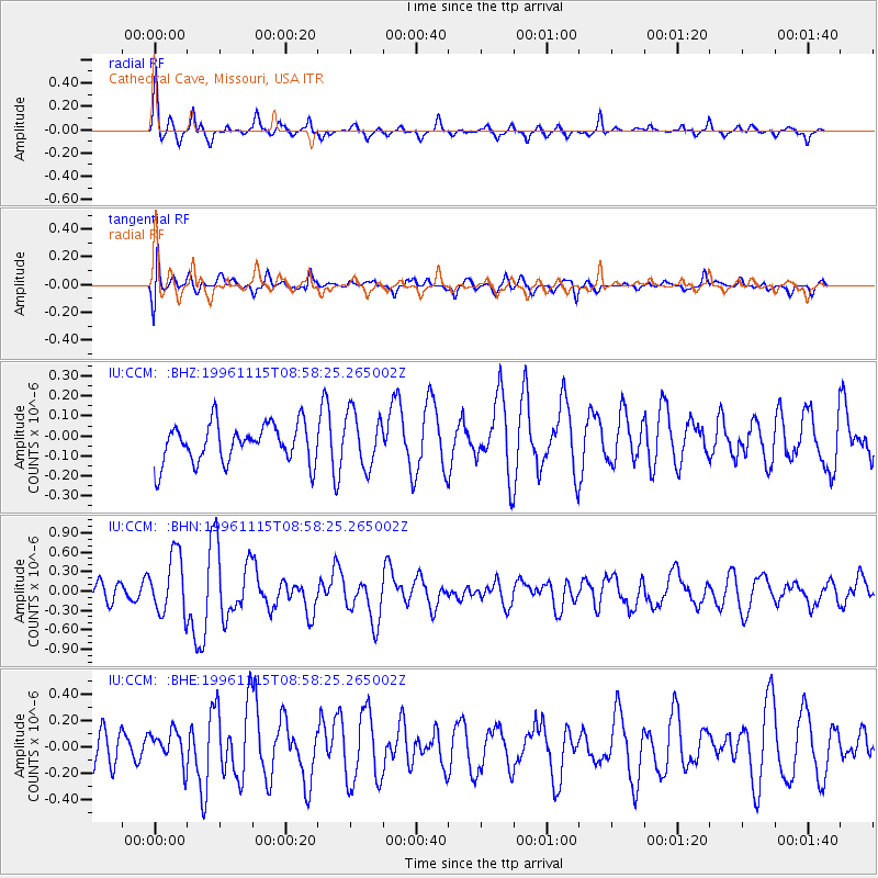
CCM Cathedral Cave, Missouri, USA - Earthquake Result Viewer
*The percent match for this event was below the threshold and hence no stack was calculated.
| Earthquake location: |
Near Coast Of Peru |
| Earthquake latitude/longitude: |
-14.8/-75.5 |
| Earthquake time(UTC): |
1996/11/15 (320) 08:49:30 GMT |
| Earthquake Depth: |
33 km |
| Earthquake Magnitude: |
5.5 MS, 5.2 MB |
| Earthquake Catalog/Contributor: |
WHDF/NEIC |
|
| Network: |
IU Global Seismograph Network (GSN - IRIS/USGS) |
| Station: |
CCM Cathedral Cave, Missouri, USA |
| Lat/Lon: |
38.06 N/91.24 W |
| Elevation: |
222 m |
|
| Distance: |
54.6 deg |
| Az: |
344.744 deg |
| Baz: |
161.19 deg |
| Ray Param: |
$rayparam |
*The percent match for this event was below the threshold and hence was not used in the summary stack. |
|
| Radial Match: |
77.29509 % |
| Radial Bump: |
316 |
| Transverse Match: |
46.14764 % |
| Transverse Bump: |
400 |
| SOD ConfigId: |
4480 |
| Insert Time: |
2010-03-04 15:49:07.455 +0000 |
| GWidth: |
2.5 |
| Max Bumps: |
400 |
| Tol: |
0.001 |
|
Signal To Noise
| Channel | StoN | STA | LTA |
| IU:CCM: :BHN:19961115T08:58:25.265002Z | 2.3568006 | 4.649029E-7 | 1.9726019E-7 |
| IU:CCM: :BHE:19961115T08:58:25.265002Z | 0.75317323 | 1.3215319E-7 | 1.7546188E-7 |
| IU:CCM: :BHZ:19961115T08:58:25.265002Z | 1.4092708 | 1.3631288E-7 | 9.672583E-8 |
| Arrivals |
| Ps | |
| PpPs | |
| PsPs/PpSs | |


