You are here: Home > Network List > IU - Global Seismograph Network (GSN - IRIS/USGS) Stations List
> Station CCM Cathedral Cave, Missouri, USA > Earthquake Result Viewer
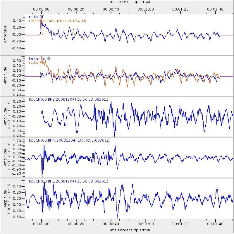
CCM Cathedral Cave, Missouri, USA - Earthquake Result Viewer
*The percent match for this event was below the threshold and hence no stack was calculated.
| Earthquake location: |
Chile-Bolivia Border Region |
| Earthquake latitude/longitude: |
-21.4/-68.3 |
| Earthquake time(UTC): |
2008/12/04 (339) 16:47:09 GMT |
| Earthquake Depth: |
115 km |
| Earthquake Magnitude: |
5.5 MB, 5.5 MW, 5.5 MW |
| Earthquake Catalog/Contributor: |
WHDF/NEIC |
|
| Network: |
IU Global Seismograph Network (GSN - IRIS/USGS) |
| Station: |
CCM Cathedral Cave, Missouri, USA |
| Lat/Lon: |
38.06 N/91.24 W |
| Elevation: |
222 m |
|
| Distance: |
62.9 deg |
| Az: |
339.773 deg |
| Baz: |
155.911 deg |
| Ray Param: |
$rayparam |
*The percent match for this event was below the threshold and hence was not used in the summary stack. |
|
| Radial Match: |
50.798695 % |
| Radial Bump: |
400 |
| Transverse Match: |
49.353516 % |
| Transverse Bump: |
400 |
| SOD ConfigId: |
2658 |
| Insert Time: |
2010-03-04 15:49:11.714 +0000 |
| GWidth: |
2.5 |
| Max Bumps: |
400 |
| Tol: |
0.001 |
|
Signal To Noise
| Channel | StoN | STA | LTA |
| IU:CCM:00:BHN:20081204T16:56:53.08301Z | 2.7418213 | 4.7058262E-7 | 1.716314E-7 |
| IU:CCM:00:BHE:20081204T16:56:53.08301Z | 1.2784714 | 2.4247512E-7 | 1.896602E-7 |
| IU:CCM:00:BHZ:20081204T16:56:53.08301Z | 0.8337007 | 1.1157096E-7 | 1.3382615E-7 |
| Arrivals |
| Ps | |
| PpPs | |
| PsPs/PpSs | |


