You are here: Home > Network List > TA - USArray Transportable Network (new EarthScope stations) Stations List
> Station J62A Henniker, NH, USA > Earthquake Result Viewer
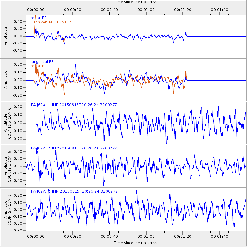
J62A Henniker, NH, USA - Earthquake Result Viewer
*The percent match for this event was below the threshold and hence no stack was calculated.
| Earthquake location: |
Andreanof Islands, Aleutian Is. |
| Earthquake latitude/longitude: |
51.7/-175.2 |
| Earthquake time(UTC): |
2015/08/15 (227) 20:16:21 GMT |
| Earthquake Depth: |
32 km |
| Earthquake Magnitude: |
5.6 MWB, 5.5 MI, 5.6 ML, 5.6 MWC |
| Earthquake Catalog/Contributor: |
NEIC PDE/NEIC COMCAT |
|
| Network: |
TA USArray Transportable Network (new EarthScope stations) |
| Station: |
J62A Henniker, NH, USA |
| Lat/Lon: |
43.23 N/71.81 W |
| Elevation: |
266 m |
|
| Distance: |
64.6 deg |
| Az: |
51.934 deg |
| Baz: |
317.875 deg |
| Ray Param: |
$rayparam |
*The percent match for this event was below the threshold and hence was not used in the summary stack. |
|
| Radial Match: |
55.475204 % |
| Radial Bump: |
400 |
| Transverse Match: |
41.298557 % |
| Transverse Bump: |
400 |
| SOD ConfigId: |
7422571 |
| Insert Time: |
2019-04-20 11:32:26.833 +0000 |
| GWidth: |
2.5 |
| Max Bumps: |
400 |
| Tol: |
0.001 |
|
Signal To Noise
| Channel | StoN | STA | LTA |
| TA:J62A: :HHZ:20150815T20:26:24.320027Z | 2.011755 | 2.4290637E-7 | 1.2074352E-7 |
| TA:J62A: :HHN:20150815T20:26:24.320027Z | 1.209591 | 7.771697E-8 | 6.425062E-8 |
| TA:J62A: :HHE:20150815T20:26:24.320027Z | 1.1830962 | 8.148523E-8 | 6.887457E-8 |
| Arrivals |
| Ps | |
| PpPs | |
| PsPs/PpSs | |


