You are here: Home > Network List > IU - Global Seismograph Network (GSN - IRIS/USGS) Stations List
> Station CCM Cathedral Cave, Missouri, USA > Earthquake Result Viewer
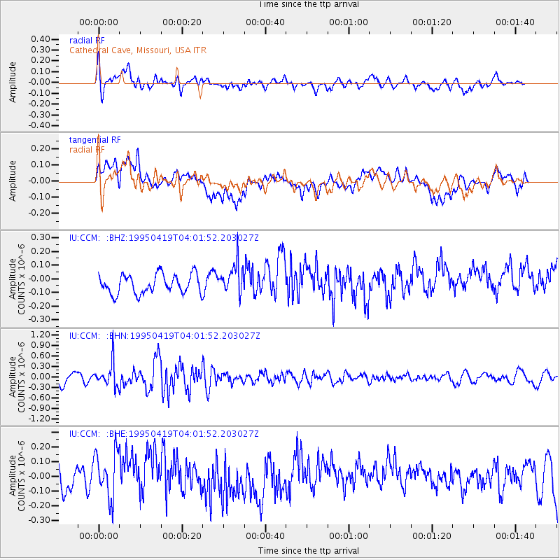
CCM Cathedral Cave, Missouri, USA - Earthquake Result Viewer
*The percent match for this event was below the threshold and hence no stack was calculated.
| Earthquake location: |
Kuril Islands |
| Earthquake latitude/longitude: |
44.0/148.2 |
| Earthquake time(UTC): |
1995/04/19 (109) 03:50:05 GMT |
| Earthquake Depth: |
33 km |
| Earthquake Magnitude: |
5.9 MB, 5.5 MS, 5.8 UNKNOWN, 5.7 MW |
| Earthquake Catalog/Contributor: |
WHDF/NEIC |
|
| Network: |
IU Global Seismograph Network (GSN - IRIS/USGS) |
| Station: |
CCM Cathedral Cave, Missouri, USA |
| Lat/Lon: |
38.06 N/91.24 W |
| Elevation: |
222 m |
|
| Distance: |
82.2 deg |
| Az: |
43.328 deg |
| Baz: |
321.171 deg |
| Ray Param: |
$rayparam |
*The percent match for this event was below the threshold and hence was not used in the summary stack. |
|
| Radial Match: |
51.228493 % |
| Radial Bump: |
400 |
| Transverse Match: |
28.376255 % |
| Transverse Bump: |
400 |
| SOD ConfigId: |
4480 |
| Insert Time: |
2010-03-04 15:49:44.794 +0000 |
| GWidth: |
2.5 |
| Max Bumps: |
400 |
| Tol: |
0.001 |
|
Signal To Noise
| Channel | StoN | STA | LTA |
| IU:CCM: :BHN:19950419T04:01:52.203027Z | 2.6324618 | 3.622989E-7 | 1.3762741E-7 |
| IU:CCM: :BHE:19950419T04:01:52.203027Z | 1.7038325 | 1.8961136E-7 | 1.112852E-7 |
| IU:CCM: :BHZ:19950419T04:01:52.203027Z | 1.7059404 | 1.183409E-7 | 6.936989E-8 |
| Arrivals |
| Ps | |
| PpPs | |
| PsPs/PpSs | |


