You are here: Home > Network List > IU - Global Seismograph Network (GSN - IRIS/USGS) Stations List
> Station PMG Port Moresby, New Guinea > Earthquake Result Viewer
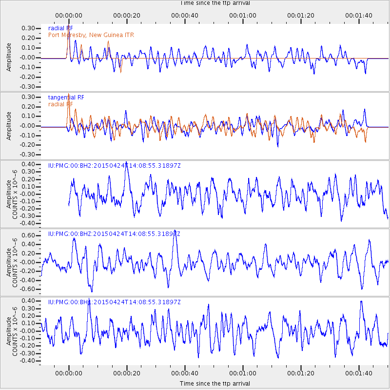
PMG Port Moresby, New Guinea - Earthquake Result Viewer
*The percent match for this event was below the threshold and hence no stack was calculated.
| Earthquake location: |
Queen Charlotte Islands Region |
| Earthquake latitude/longitude: |
51.7/-130.8 |
| Earthquake time(UTC): |
2015/04/24 (114) 13:56:16 GMT |
| Earthquake Depth: |
10 km |
| Earthquake Magnitude: |
6.1 MO |
| Earthquake Catalog/Contributor: |
NEIC PDE/NEIC ALERT |
|
| Network: |
IU Global Seismograph Network (GSN - IRIS/USGS) |
| Station: |
PMG Port Moresby, New Guinea |
| Lat/Lon: |
9.40 S/147.16 E |
| Elevation: |
90 m |
|
| Distance: |
92.4 deg |
| Az: |
258.024 deg |
| Baz: |
38.059 deg |
| Ray Param: |
$rayparam |
*The percent match for this event was below the threshold and hence was not used in the summary stack. |
|
| Radial Match: |
47.48392 % |
| Radial Bump: |
400 |
| Transverse Match: |
50.42855 % |
| Transverse Bump: |
400 |
| SOD ConfigId: |
872571 |
| Insert Time: |
2015-05-08 14:27:30.906 +0000 |
| GWidth: |
2.5 |
| Max Bumps: |
400 |
| Tol: |
0.001 |
|
Signal To Noise
| Channel | StoN | STA | LTA |
| IU:PMG:00:BHZ:20150424T14:08:55.31897Z | 2.2738442 | 2.5213214E-7 | 1.1088364E-7 |
| IU:PMG:00:BH1:20150424T14:08:55.31897Z | 1.3951681 | 1.3750486E-7 | 9.855791E-8 |
| IU:PMG:00:BH2:20150424T14:08:55.31897Z | 1.0110898 | 1.482583E-7 | 1.4663217E-7 |
| Arrivals |
| Ps | |
| PpPs | |
| PsPs/PpSs | |


