You are here: Home > Network List > UW - Pacific Northwest Regional Seismic Network Stations List
> Station MRBL Marblemount, WA, USA > Earthquake Result Viewer
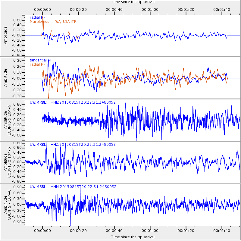
MRBL Marblemount, WA, USA - Earthquake Result Viewer
*The percent match for this event was below the threshold and hence no stack was calculated.
| Earthquake location: |
Andreanof Islands, Aleutian Is. |
| Earthquake latitude/longitude: |
51.7/-175.2 |
| Earthquake time(UTC): |
2015/08/15 (227) 20:16:21 GMT |
| Earthquake Depth: |
32 km |
| Earthquake Magnitude: |
5.6 MWB, 5.5 MI, 5.6 ML, 5.6 MWC |
| Earthquake Catalog/Contributor: |
NEIC PDE/NEIC COMCAT |
|
| Network: |
UW Pacific Northwest Regional Seismic Network |
| Station: |
MRBL Marblemount, WA, USA |
| Lat/Lon: |
48.52 N/121.48 W |
| Elevation: |
75 m |
|
| Distance: |
33.9 deg |
| Az: |
73.666 deg |
| Baz: |
295.996 deg |
| Ray Param: |
$rayparam |
*The percent match for this event was below the threshold and hence was not used in the summary stack. |
|
| Radial Match: |
59.221474 % |
| Radial Bump: |
400 |
| Transverse Match: |
51.395298 % |
| Transverse Bump: |
400 |
| SOD ConfigId: |
7422571 |
| Insert Time: |
2019-04-20 11:34:08.188 +0000 |
| GWidth: |
2.5 |
| Max Bumps: |
400 |
| Tol: |
0.001 |
|
Signal To Noise
| Channel | StoN | STA | LTA |
| UW:MRBL: :HHZ:20150815T20:22:31.248005Z | 5.29752 | 2.5662894E-7 | 4.844322E-8 |
| UW:MRBL: :HHN:20150815T20:22:31.248005Z | 1.8752311 | 1.6868306E-7 | 8.995321E-8 |
| UW:MRBL: :HHE:20150815T20:22:31.248005Z | 1.5096825 | 1.3693986E-7 | 9.070772E-8 |
| Arrivals |
| Ps | |
| PpPs | |
| PsPs/PpSs | |


