You are here: Home > Network List > IU - Global Seismograph Network (GSN - IRIS/USGS) Stations List
> Station CCM Cathedral Cave, Missouri, USA > Earthquake Result Viewer
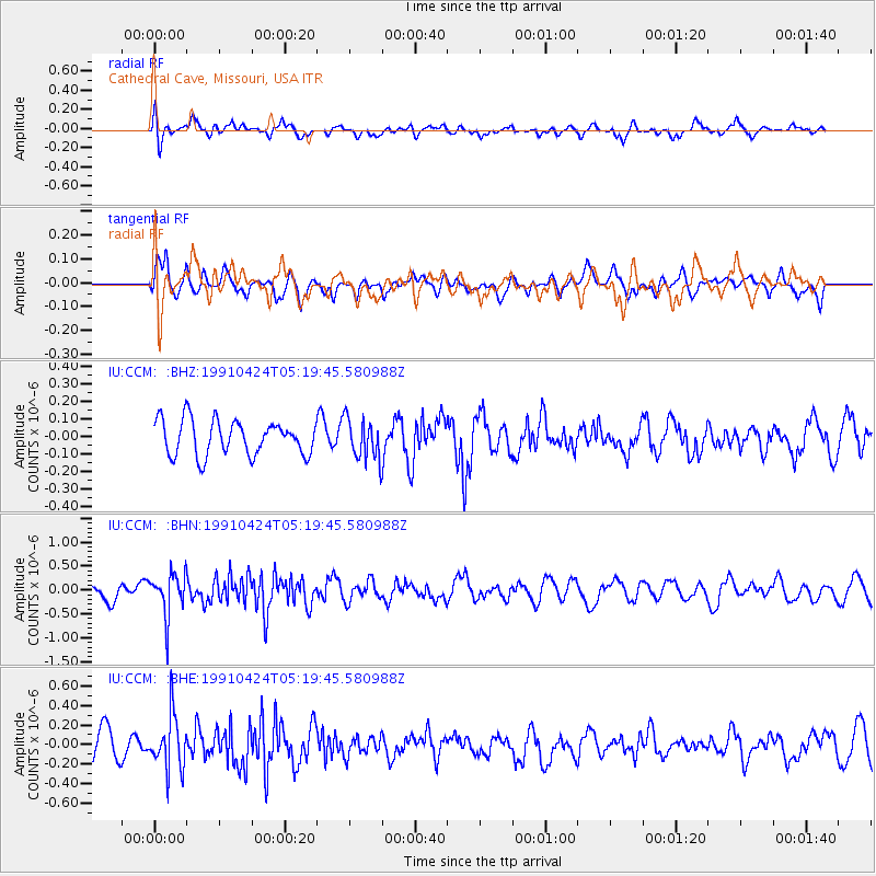
CCM Cathedral Cave, Missouri, USA - Earthquake Result Viewer
*The percent match for this event was below the threshold and hence no stack was calculated.
| Earthquake location: |
South Of Panama |
| Earthquake latitude/longitude: |
2.6/-79.7 |
| Earthquake time(UTC): |
1991/04/24 (114) 05:13:10 GMT |
| Earthquake Depth: |
24 km |
| Earthquake Magnitude: |
5.7 MB, 5.9 MS, 5.9 UNKNOWN |
| Earthquake Catalog/Contributor: |
WHDF/NEIC |
|
| Network: |
IU Global Seismograph Network (GSN - IRIS/USGS) |
| Station: |
CCM Cathedral Cave, Missouri, USA |
| Lat/Lon: |
38.06 N/91.24 W |
| Elevation: |
222 m |
|
| Distance: |
36.8 deg |
| Az: |
344.761 deg |
| Baz: |
160.572 deg |
| Ray Param: |
$rayparam |
*The percent match for this event was below the threshold and hence was not used in the summary stack. |
|
| Radial Match: |
60.94028 % |
| Radial Bump: |
400 |
| Transverse Match: |
55.13761 % |
| Transverse Bump: |
400 |
| SOD ConfigId: |
4480 |
| Insert Time: |
2010-03-04 15:50:10.984 +0000 |
| GWidth: |
2.5 |
| Max Bumps: |
400 |
| Tol: |
0.001 |
|
Signal To Noise
| Channel | StoN | STA | LTA |
| IU:CCM: :BHN:19910424T05:19:45.580988Z | 3.2461615 | 4.4646936E-7 | 1.3753763E-7 |
| IU:CCM: :BHE:19910424T05:19:45.580988Z | 2.344329 | 2.7579725E-7 | 1.1764442E-7 |
| IU:CCM: :BHZ:19910424T05:19:45.580988Z | 1.1787995 | 1.1761603E-7 | 9.9776116E-8 |
| Arrivals |
| Ps | |
| PpPs | |
| PsPs/PpSs | |


