You are here: Home > Network List > IU - Global Seismograph Network (GSN - IRIS/USGS) Stations List
> Station CCM Cathedral Cave, Missouri, USA > Earthquake Result Viewer
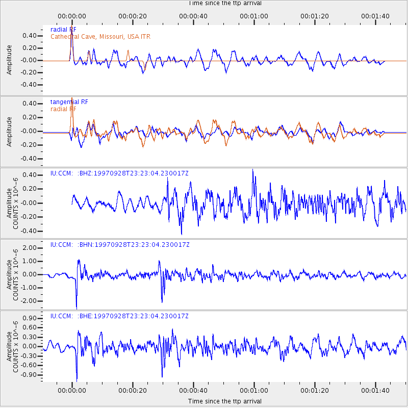
CCM Cathedral Cave, Missouri, USA - Earthquake Result Viewer
*The percent match for this event was below the threshold and hence no stack was calculated.
| Earthquake location: |
Northern Chile |
| Earthquake latitude/longitude: |
-22.4/-68.4 |
| Earthquake time(UTC): |
1997/09/28 (271) 23:13:13 GMT |
| Earthquake Depth: |
107 km |
| Earthquake Magnitude: |
5.7 MB, 5.6 UNKNOWN, 5.6 MW |
| Earthquake Catalog/Contributor: |
WHDF/NEIC |
|
| Network: |
IU Global Seismograph Network (GSN - IRIS/USGS) |
| Station: |
CCM Cathedral Cave, Missouri, USA |
| Lat/Lon: |
38.06 N/91.24 W |
| Elevation: |
222 m |
|
| Distance: |
63.8 deg |
| Az: |
340.078 deg |
| Baz: |
156.457 deg |
| Ray Param: |
$rayparam |
*The percent match for this event was below the threshold and hence was not used in the summary stack. |
|
| Radial Match: |
65.05864 % |
| Radial Bump: |
400 |
| Transverse Match: |
66.04194 % |
| Transverse Bump: |
400 |
| SOD ConfigId: |
4480 |
| Insert Time: |
2010-03-04 15:50:14.111 +0000 |
| GWidth: |
2.5 |
| Max Bumps: |
400 |
| Tol: |
0.001 |
|
Signal To Noise
| Channel | StoN | STA | LTA |
| IU:CCM: :BHN:19970928T23:23:04.230017Z | 4.7162747 | 7.079977E-7 | 1.50118E-7 |
| IU:CCM: :BHE:19970928T23:23:04.230017Z | 2.4193602 | 3.135373E-7 | 1.2959512E-7 |
| IU:CCM: :BHZ:19970928T23:23:04.230017Z | 1.9470105 | 1.3060964E-7 | 6.708214E-8 |
| Arrivals |
| Ps | |
| PpPs | |
| PsPs/PpSs | |


