You are here: Home > Network List > CI - Caltech Regional Seismic Network Stations List
> Station GLA Glamis, Glamis, CA, USA > Earthquake Result Viewer
GLA Glamis, Glamis, CA, USA - Earthquake Result Viewer
*The percent match for this event was below the threshold and hence no stack was calculated.
| Earthquake location: |
Tonga Islands |
| Earthquake latitude/longitude: |
-15.5/-173.8 |
| Earthquake time(UTC): |
2009/11/01 (305) 21:28:58 GMT |
| Earthquake Depth: |
105 km |
| Earthquake Magnitude: |
5.8 MW, 5.4 MB, 5.8 MW |
| Earthquake Catalog/Contributor: |
WHDF/NEIC |
|
| Network: |
CI Caltech Regional Seismic Network |
| Station: |
GLA Glamis, Glamis, CA, USA |
| Lat/Lon: |
33.05 N/114.83 W |
| Elevation: |
610 m |
|
| Distance: |
74.1 deg |
| Az: |
48.408 deg |
| Baz: |
239.149 deg |
| Ray Param: |
$rayparam |
*The percent match for this event was below the threshold and hence was not used in the summary stack. |
|
| Radial Match: |
66.31118 % |
| Radial Bump: |
400 |
| Transverse Match: |
60.558754 % |
| Transverse Bump: |
400 |
| SOD ConfigId: |
2622 |
| Insert Time: |
2010-02-25 23:37:49.358 +0000 |
| GWidth: |
2.5 |
| Max Bumps: |
400 |
| Tol: |
0.001 |
|
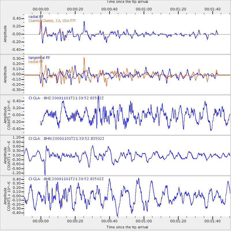
Signal To Noise
| Channel | StoN | STA | LTA |
| CI:GLA: :BHN:20091101T21:39:52.83502Z | 2.395671 | 4.887452E-7 | 2.0401183E-7 |
| CI:GLA: :BHE:20091101T21:39:52.83502Z | 1.2049564 | 1.3926518E-7 | 1.1557694E-7 |
| CI:GLA: :BHZ:20091101T21:39:52.83502Z | 1.6289421 | 2.399483E-7 | 1.4730314E-7 |
| Arrivals |
| Ps | |
| PpPs | |
| PsPs/PpSs | |


