You are here: Home > Network List > IU - Global Seismograph Network (GSN - IRIS/USGS) Stations List
> Station CCM Cathedral Cave, Missouri, USA > Earthquake Result Viewer
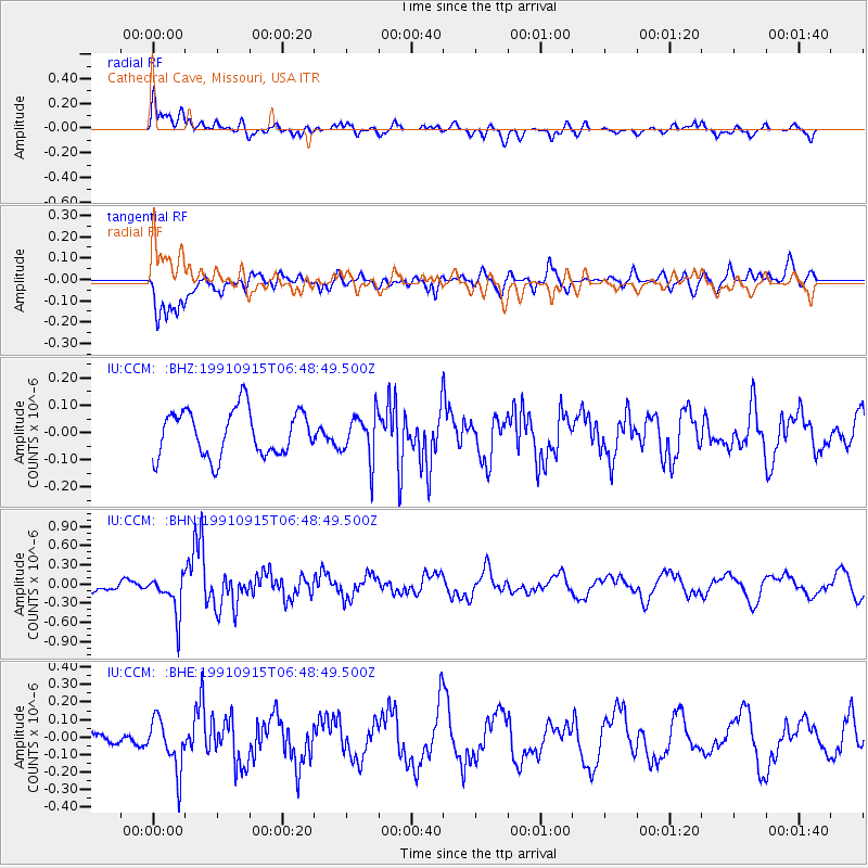
CCM Cathedral Cave, Missouri, USA - Earthquake Result Viewer
*The percent match for this event was below the threshold and hence no stack was calculated.
| Earthquake location: |
Southern East Pacific Rise |
| Earthquake latitude/longitude: |
-17.8/-115.9 |
| Earthquake time(UTC): |
1991/09/15 (258) 06:39:12 GMT |
| Earthquake Depth: |
10 km |
| Earthquake Magnitude: |
5.6 MB, 4.7 MS |
| Earthquake Catalog/Contributor: |
WHDF/NEIC |
|
| Network: |
IU Global Seismograph Network (GSN - IRIS/USGS) |
| Station: |
CCM Cathedral Cave, Missouri, USA |
| Lat/Lon: |
38.06 N/91.24 W |
| Elevation: |
222 m |
|
| Distance: |
60.2 deg |
| Az: |
22.329 deg |
| Baz: |
207.291 deg |
| Ray Param: |
$rayparam |
*The percent match for this event was below the threshold and hence was not used in the summary stack. |
|
| Radial Match: |
66.73219 % |
| Radial Bump: |
400 |
| Transverse Match: |
67.20548 % |
| Transverse Bump: |
400 |
| SOD ConfigId: |
4480 |
| Insert Time: |
2010-03-04 15:50:17.569 +0000 |
| GWidth: |
2.5 |
| Max Bumps: |
400 |
| Tol: |
0.001 |
|
Signal To Noise
| Channel | StoN | STA | LTA |
| IU:CCM: :BHN:19910915T06:48:49.500Z | 1.9163654 | 3.1168037E-7 | 1.6264141E-7 |
| IU:CCM: :BHE:19910915T06:48:49.500Z | 1.8437315 | 1.4761471E-7 | 8.006302E-8 |
| IU:CCM: :BHZ:19910915T06:48:49.500Z | 0.99117005 | 8.35723E-8 | 8.431682E-8 |
| Arrivals |
| Ps | |
| PpPs | |
| PsPs/PpSs | |


