You are here: Home > Network List > IU - Global Seismograph Network (GSN - IRIS/USGS) Stations List
> Station CCM Cathedral Cave, Missouri, USA > Earthquake Result Viewer
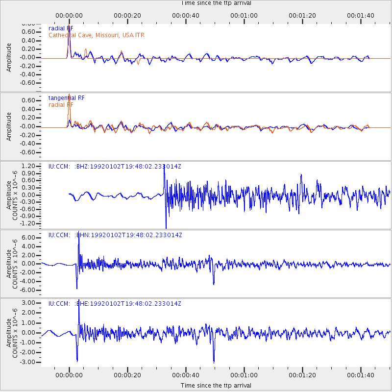
CCM Cathedral Cave, Missouri, USA - Earthquake Result Viewer
*The percent match for this event was below the threshold and hence no stack was calculated.
| Earthquake location: |
Colombia |
| Earthquake latitude/longitude: |
5.7/-73.8 |
| Earthquake time(UTC): |
1992/01/02 (002) 19:41:45 GMT |
| Earthquake Depth: |
141 km |
| Earthquake Magnitude: |
5.8 MB, 5.2 MD |
| Earthquake Catalog/Contributor: |
WHDF/NEIC |
|
| Network: |
IU Global Seismograph Network (GSN - IRIS/USGS) |
| Station: |
CCM Cathedral Cave, Missouri, USA |
| Lat/Lon: |
38.06 N/91.24 W |
| Elevation: |
222 m |
|
| Distance: |
35.9 deg |
| Az: |
336.262 deg |
| Baz: |
149.504 deg |
| Ray Param: |
$rayparam |
*The percent match for this event was below the threshold and hence was not used in the summary stack. |
|
| Radial Match: |
75.90541 % |
| Radial Bump: |
393 |
| Transverse Match: |
68.4995 % |
| Transverse Bump: |
400 |
| SOD ConfigId: |
4480 |
| Insert Time: |
2010-03-04 15:50:27.254 +0000 |
| GWidth: |
2.5 |
| Max Bumps: |
400 |
| Tol: |
0.001 |
|
Signal To Noise
| Channel | StoN | STA | LTA |
| IU:CCM: :BHN:19920102T19:48:02.233014Z | 11.107496 | 1.892402E-6 | 1.703716E-7 |
| IU:CCM: :BHE:19920102T19:48:02.233014Z | 6.276398 | 9.689525E-7 | 1.5438032E-7 |
| IU:CCM: :BHZ:19920102T19:48:02.233014Z | 4.8468633 | 4.242848E-7 | 8.753801E-8 |
| Arrivals |
| Ps | |
| PpPs | |
| PsPs/PpSs | |


