You are here: Home > Network List > IU - Global Seismograph Network (GSN - IRIS/USGS) Stations List
> Station CCM Cathedral Cave, Missouri, USA > Earthquake Result Viewer
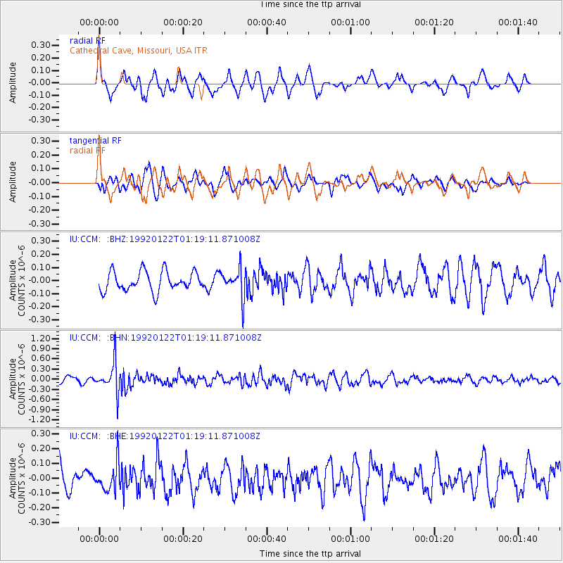
CCM Cathedral Cave, Missouri, USA - Earthquake Result Viewer
*The percent match for this event was below the threshold and hence no stack was calculated.
| Earthquake location: |
Eastern Honshu, Japan |
| Earthquake latitude/longitude: |
38.5/140.4 |
| Earthquake time(UTC): |
1992/01/22 (022) 01:06:55 GMT |
| Earthquake Depth: |
116 km |
| Earthquake Magnitude: |
5.5 MB |
| Earthquake Catalog/Contributor: |
WHDF/NEIC |
|
| Network: |
IU Global Seismograph Network (GSN - IRIS/USGS) |
| Station: |
CCM Cathedral Cave, Missouri, USA |
| Lat/Lon: |
38.06 N/91.24 W |
| Elevation: |
222 m |
|
| Distance: |
90.3 deg |
| Az: |
38.22 deg |
| Baz: |
322.027 deg |
| Ray Param: |
$rayparam |
*The percent match for this event was below the threshold and hence was not used in the summary stack. |
|
| Radial Match: |
57.41792 % |
| Radial Bump: |
388 |
| Transverse Match: |
49.428093 % |
| Transverse Bump: |
356 |
| SOD ConfigId: |
4480 |
| Insert Time: |
2010-03-04 15:50:29.026 +0000 |
| GWidth: |
2.5 |
| Max Bumps: |
400 |
| Tol: |
0.001 |
|
Signal To Noise
| Channel | StoN | STA | LTA |
| IU:CCM: :BHN:19920122T01:19:11.871008Z | 4.971721 | 4.499659E-7 | 9.0505054E-8 |
| IU:CCM: :BHE:19920122T01:19:11.871008Z | 0.9518946 | 9.860334E-8 | 1.0358641E-7 |
| IU:CCM: :BHZ:19920122T01:19:11.871008Z | 1.4878924 | 1.10569154E-7 | 7.4312595E-8 |
| Arrivals |
| Ps | |
| PpPs | |
| PsPs/PpSs | |


