You are here: Home > Network List > TA - USArray Transportable Network (new EarthScope stations) Stations List
> Station R11A Troy Canyon, Currant, NV, USA > Earthquake Result Viewer
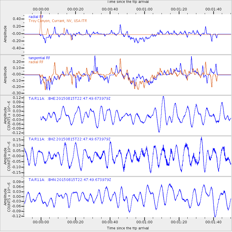
R11A Troy Canyon, Currant, NV, USA - Earthquake Result Viewer
*The percent match for this event was below the threshold and hence no stack was calculated.
| Earthquake location: |
Kuril Islands |
| Earthquake latitude/longitude: |
45.9/150.8 |
| Earthquake time(UTC): |
2015/08/15 (227) 22:37:45 GMT |
| Earthquake Depth: |
100 km |
| Earthquake Magnitude: |
4.3 mb |
| Earthquake Catalog/Contributor: |
ISC/ISC |
|
| Network: |
TA USArray Transportable Network (new EarthScope stations) |
| Station: |
R11A Troy Canyon, Currant, NV, USA |
| Lat/Lon: |
38.35 N/115.59 W |
| Elevation: |
1756 m |
|
| Distance: |
65.9 deg |
| Az: |
59.271 deg |
| Baz: |
310.263 deg |
| Ray Param: |
$rayparam |
*The percent match for this event was below the threshold and hence was not used in the summary stack. |
|
| Radial Match: |
56.255066 % |
| Radial Bump: |
400 |
| Transverse Match: |
52.36139 % |
| Transverse Bump: |
400 |
| SOD ConfigId: |
7422571 |
| Insert Time: |
2019-04-20 11:44:31.980 +0000 |
| GWidth: |
2.5 |
| Max Bumps: |
400 |
| Tol: |
0.001 |
|
Signal To Noise
| Channel | StoN | STA | LTA |
| TA:R11A: :BHZ:20150815T22:47:49.673979Z | 0.7763702 | 3.9599225E-8 | 5.1005593E-8 |
| TA:R11A: :BHN:20150815T22:47:49.673979Z | 1.1515548 | 5.8326584E-8 | 5.065029E-8 |
| TA:R11A: :BHE:20150815T22:47:49.673979Z | 1.5438273 | 4.7802626E-8 | 3.096371E-8 |
| Arrivals |
| Ps | |
| PpPs | |
| PsPs/PpSs | |


