You are here: Home > Network List > US - United States National Seismic Network Stations List
> Station AMTX Amarillo, Texas, USA > Earthquake Result Viewer
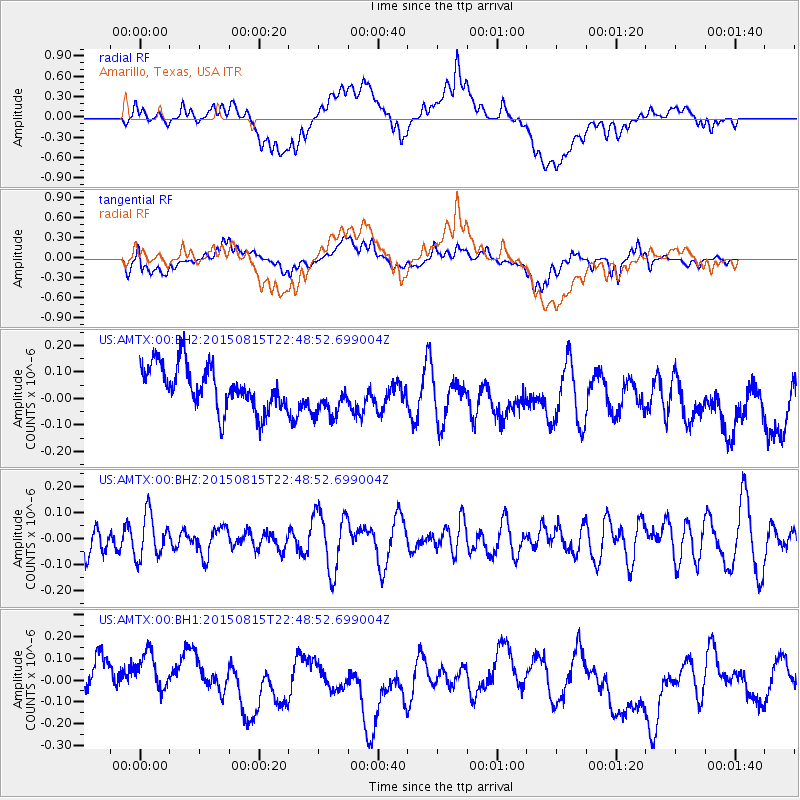
AMTX Amarillo, Texas, USA - Earthquake Result Viewer
*The percent match for this event was below the threshold and hence no stack was calculated.
| Earthquake location: |
Kuril Islands |
| Earthquake latitude/longitude: |
45.9/150.8 |
| Earthquake time(UTC): |
2015/08/15 (227) 22:37:45 GMT |
| Earthquake Depth: |
100 km |
| Earthquake Magnitude: |
4.3 mb |
| Earthquake Catalog/Contributor: |
ISC/ISC |
|
| Network: |
US United States National Seismic Network |
| Station: |
AMTX Amarillo, Texas, USA |
| Lat/Lon: |
34.53 N/101.41 W |
| Elevation: |
1010 m |
|
| Distance: |
76.8 deg |
| Az: |
53.86 deg |
| Baz: |
316.941 deg |
| Ray Param: |
$rayparam |
*The percent match for this event was below the threshold and hence was not used in the summary stack. |
|
| Radial Match: |
39.207813 % |
| Radial Bump: |
400 |
| Transverse Match: |
50.801945 % |
| Transverse Bump: |
400 |
| SOD ConfigId: |
7422571 |
| Insert Time: |
2019-04-20 11:45:03.004 +0000 |
| GWidth: |
2.5 |
| Max Bumps: |
400 |
| Tol: |
0.001 |
|
Signal To Noise
| Channel | StoN | STA | LTA |
| US:AMTX:00:BHZ:20150815T22:48:52.699004Z | 1.4702047 | 8.251225E-8 | 5.6122964E-8 |
| US:AMTX:00:BH1:20150815T22:48:52.699004Z | 0.9728118 | 1.12631376E-7 | 1.157792E-7 |
| US:AMTX:00:BH2:20150815T22:48:52.699004Z | 0.8302715 | 7.0904925E-8 | 8.539969E-8 |
| Arrivals |
| Ps | |
| PpPs | |
| PsPs/PpSs | |


