You are here: Home > Network List > IU - Global Seismograph Network (GSN - IRIS/USGS) Stations List
> Station CCM Cathedral Cave, Missouri, USA > Earthquake Result Viewer
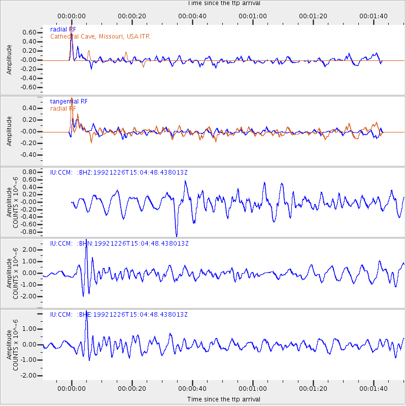
CCM Cathedral Cave, Missouri, USA - Earthquake Result Viewer
*The percent match for this event was below the threshold and hence no stack was calculated.
| Earthquake location: |
Ecuador |
| Earthquake latitude/longitude: |
-1.0/-78.1 |
| Earthquake time(UTC): |
1992/12/26 (361) 14:57:38 GMT |
| Earthquake Depth: |
10 km |
| Earthquake Magnitude: |
5.8 MB, 5.4 MS |
| Earthquake Catalog/Contributor: |
WHDF/NEIC |
|
| Network: |
IU Global Seismograph Network (GSN - IRIS/USGS) |
| Station: |
CCM Cathedral Cave, Missouri, USA |
| Lat/Lon: |
38.06 N/91.24 W |
| Elevation: |
222 m |
|
| Distance: |
40.7 deg |
| Az: |
344.036 deg |
| Baz: |
159.614 deg |
| Ray Param: |
$rayparam |
*The percent match for this event was below the threshold and hence was not used in the summary stack. |
|
| Radial Match: |
56.550186 % |
| Radial Bump: |
400 |
| Transverse Match: |
71.29428 % |
| Transverse Bump: |
400 |
| SOD ConfigId: |
4480 |
| Insert Time: |
2010-03-04 15:50:59.226 +0000 |
| GWidth: |
2.5 |
| Max Bumps: |
400 |
| Tol: |
0.001 |
|
Signal To Noise
| Channel | StoN | STA | LTA |
| IU:CCM: :BHN:19921226T15:04:48.438013Z | 3.5450954 | 9.4066274E-7 | 2.65342E-7 |
| IU:CCM: :BHE:19921226T15:04:48.438013Z | 2.141709 | 5.7714084E-7 | 2.6947677E-7 |
| IU:CCM: :BHZ:19921226T15:04:48.438013Z | 1.696363 | 2.9281352E-7 | 1.7261254E-7 |
| Arrivals |
| Ps | |
| PpPs | |
| PsPs/PpSs | |


