You are here: Home > Network List > GS - US Geological Survey Networks Stations List
> Station KAN10 Keim Farm > Earthquake Result Viewer
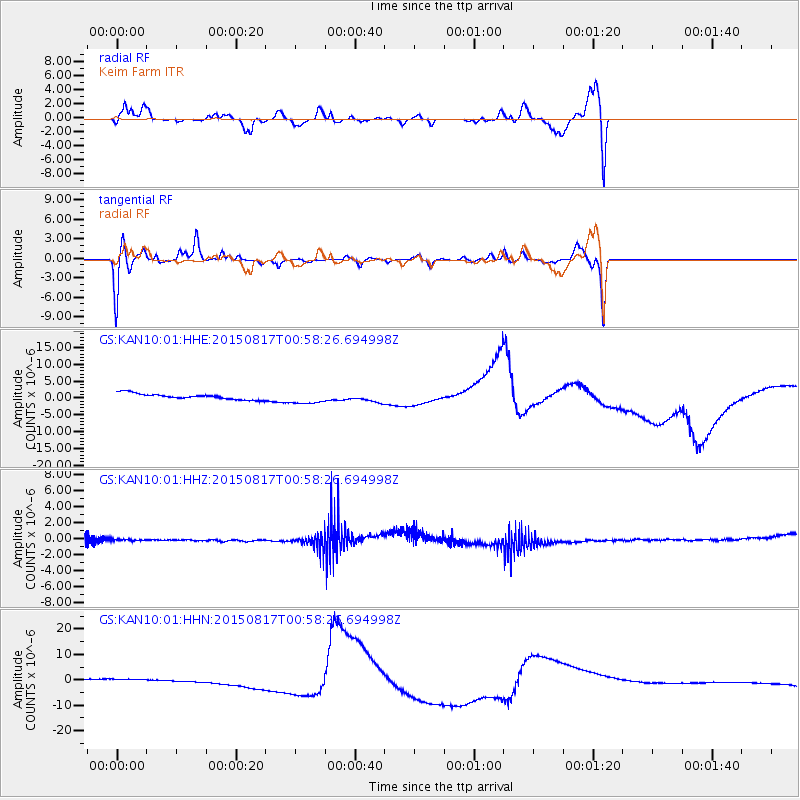
KAN10 Keim Farm - Earthquake Result Viewer
*The percent match for this event was below the threshold and hence no stack was calculated.
| Earthquake location: |
Bonin Islands, Japan Region |
| Earthquake latitude/longitude: |
27.1/143.7 |
| Earthquake time(UTC): |
2015/08/17 (229) 00:45:42 GMT |
| Earthquake Depth: |
14 km |
| Earthquake Magnitude: |
5.2 MW |
| Earthquake Catalog/Contributor: |
ISC/ISC |
|
| Network: |
GS US Geological Survey Networks |
| Station: |
KAN10 Keim Farm |
| Lat/Lon: |
37.12 N/98.10 W |
| Elevation: |
417 m |
|
| Distance: |
93.7 deg |
| Az: |
44.907 deg |
| Baz: |
308.072 deg |
| Ray Param: |
$rayparam |
*The percent match for this event was below the threshold and hence was not used in the summary stack. |
|
| Radial Match: |
46.00401 % |
| Radial Bump: |
400 |
| Transverse Match: |
66.02303 % |
| Transverse Bump: |
349 |
| SOD ConfigId: |
7422571 |
| Insert Time: |
2019-04-20 11:57:00.676 +0000 |
| GWidth: |
2.5 |
| Max Bumps: |
400 |
| Tol: |
0.001 |
|
Signal To Noise
| Channel | StoN | STA | LTA |
| GS:KAN10:01:HHZ:20150817T00:58:26.694998Z | 0.30426902 | 1.1404749E-7 | 3.748245E-7 |
| GS:KAN10:01:HHN:20150817T00:58:26.694998Z | 1.9327759 | 6.924063E-7 | 3.5824448E-7 |
| GS:KAN10:01:HHE:20150817T00:58:26.694998Z | 2.1694226 | 1.8662244E-6 | 8.6024016E-7 |
| Arrivals |
| Ps | |
| PpPs | |
| PsPs/PpSs | |


