You are here: Home > Network List > GS - US Geological Survey Networks Stations List
> Station KAN13 Rinehart Farm > Earthquake Result Viewer
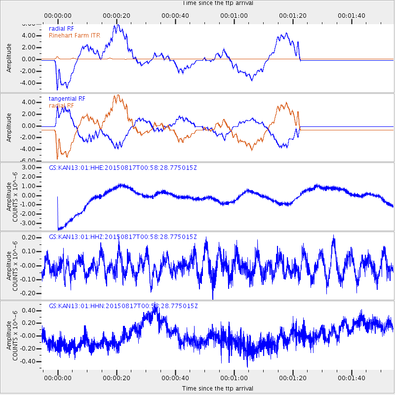
KAN13 Rinehart Farm - Earthquake Result Viewer
*The percent match for this event was below the threshold and hence no stack was calculated.
| Earthquake location: |
Bonin Islands, Japan Region |
| Earthquake latitude/longitude: |
27.1/143.7 |
| Earthquake time(UTC): |
2015/08/17 (229) 00:45:42 GMT |
| Earthquake Depth: |
14 km |
| Earthquake Magnitude: |
5.2 MW |
| Earthquake Catalog/Contributor: |
ISC/ISC |
|
| Network: |
GS US Geological Survey Networks |
| Station: |
KAN13 Rinehart Farm |
| Lat/Lon: |
37.01 N/97.48 W |
| Elevation: |
340 m |
|
| Distance: |
94.1 deg |
| Az: |
44.688 deg |
| Baz: |
308.458 deg |
| Ray Param: |
$rayparam |
*The percent match for this event was below the threshold and hence was not used in the summary stack. |
|
| Radial Match: |
54.82255 % |
| Radial Bump: |
400 |
| Transverse Match: |
61.703964 % |
| Transverse Bump: |
400 |
| SOD ConfigId: |
7422571 |
| Insert Time: |
2019-04-20 11:57:02.674 +0000 |
| GWidth: |
2.5 |
| Max Bumps: |
400 |
| Tol: |
0.001 |
|
Signal To Noise
| Channel | StoN | STA | LTA |
| GS:KAN13:01:HHZ:20150817T00:58:28.775015Z | 0.80875236 | 6.2766944E-8 | 7.760959E-8 |
| GS:KAN13:01:HHN:20150817T00:58:28.775015Z | 2.6236975 | 3.6083276E-7 | 1.3752835E-7 |
| GS:KAN13:01:HHE:20150817T00:58:28.775015Z | 0.53321844 | 8.3868423E-7 | 1.5728718E-6 |
| Arrivals |
| Ps | |
| PpPs | |
| PsPs/PpSs | |


