You are here: Home > Network List > TA - USArray Transportable Network (new EarthScope stations) Stations List
> Station N02D Trinity Center, CA, USA > Earthquake Result Viewer
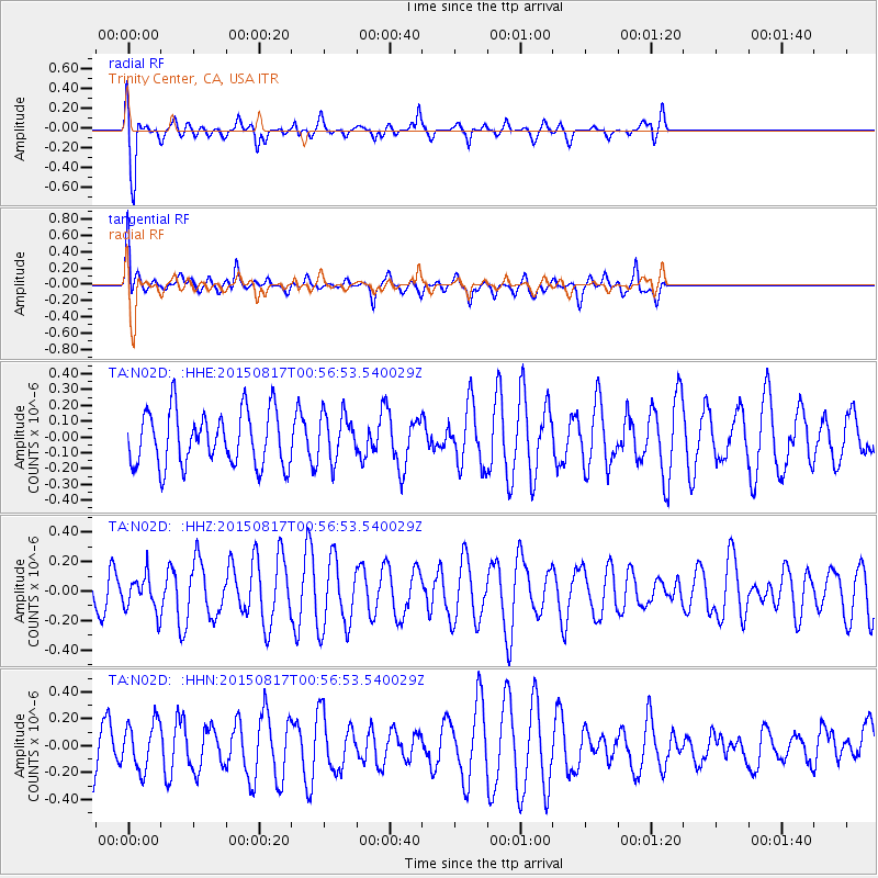
N02D Trinity Center, CA, USA - Earthquake Result Viewer
*The percent match for this event was below the threshold and hence no stack was calculated.
| Earthquake location: |
Bonin Islands, Japan Region |
| Earthquake latitude/longitude: |
27.1/143.7 |
| Earthquake time(UTC): |
2015/08/17 (229) 00:45:42 GMT |
| Earthquake Depth: |
14 km |
| Earthquake Magnitude: |
5.2 MW |
| Earthquake Catalog/Contributor: |
ISC/ISC |
|
| Network: |
TA USArray Transportable Network (new EarthScope stations) |
| Station: |
N02D Trinity Center, CA, USA |
| Lat/Lon: |
40.97 N/122.71 W |
| Elevation: |
937 m |
|
| Distance: |
75.3 deg |
| Az: |
51.385 deg |
| Baz: |
293.11 deg |
| Ray Param: |
$rayparam |
*The percent match for this event was below the threshold and hence was not used in the summary stack. |
|
| Radial Match: |
80.50808 % |
| Radial Bump: |
400 |
| Transverse Match: |
67.335594 % |
| Transverse Bump: |
400 |
| SOD ConfigId: |
7422571 |
| Insert Time: |
2019-04-20 11:59:25.210 +0000 |
| GWidth: |
2.5 |
| Max Bumps: |
400 |
| Tol: |
0.001 |
|
Signal To Noise
| Channel | StoN | STA | LTA |
| TA:N02D: :HHZ:20150817T00:56:53.540029Z | 0.8460502 | 1.1834513E-7 | 1.3987955E-7 |
| TA:N02D: :HHN:20150817T00:56:53.540029Z | 0.90593064 | 1.7367992E-7 | 1.9171438E-7 |
| TA:N02D: :HHE:20150817T00:56:53.540029Z | 0.88295084 | 1.5167342E-7 | 1.7178013E-7 |
| Arrivals |
| Ps | |
| PpPs | |
| PsPs/PpSs | |


