You are here: Home > Network List > TA - USArray Transportable Network (new EarthScope stations) Stations List
> Station O03E Paynes Creek, CA, USA > Earthquake Result Viewer
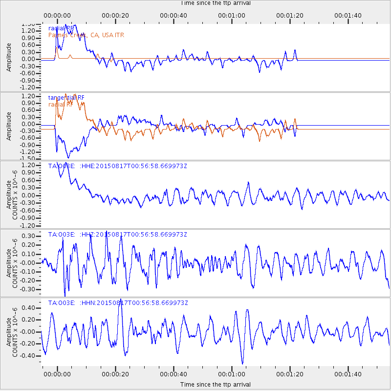
O03E Paynes Creek, CA, USA - Earthquake Result Viewer
*The percent match for this event was below the threshold and hence no stack was calculated.
| Earthquake location: |
Bonin Islands, Japan Region |
| Earthquake latitude/longitude: |
27.1/143.7 |
| Earthquake time(UTC): |
2015/08/17 (229) 00:45:42 GMT |
| Earthquake Depth: |
14 km |
| Earthquake Magnitude: |
5.2 MW |
| Earthquake Catalog/Contributor: |
ISC/ISC |
|
| Network: |
TA USArray Transportable Network (new EarthScope stations) |
| Station: |
O03E Paynes Creek, CA, USA |
| Lat/Lon: |
40.29 N/121.80 W |
| Elevation: |
967 m |
|
| Distance: |
76.2 deg |
| Az: |
51.746 deg |
| Baz: |
293.785 deg |
| Ray Param: |
$rayparam |
*The percent match for this event was below the threshold and hence was not used in the summary stack. |
|
| Radial Match: |
39.359894 % |
| Radial Bump: |
400 |
| Transverse Match: |
52.662518 % |
| Transverse Bump: |
400 |
| SOD ConfigId: |
7422571 |
| Insert Time: |
2019-04-20 11:59:26.566 +0000 |
| GWidth: |
2.5 |
| Max Bumps: |
400 |
| Tol: |
0.001 |
|
Signal To Noise
| Channel | StoN | STA | LTA |
| TA:O03E: :HHZ:20150817T00:56:58.669973Z | 1.7824266 | 1.7132889E-7 | 9.612115E-8 |
| TA:O03E: :HHN:20150817T00:56:58.669973Z | 1.0909326 | 2.0312928E-7 | 1.8619782E-7 |
| TA:O03E: :HHE:20150817T00:56:58.669973Z | 0.81582254 | 3.7494968E-7 | 4.595971E-7 |
| Arrivals |
| Ps | |
| PpPs | |
| PsPs/PpSs | |


