KONO Kongsberg, Norway - Earthquake Result Viewer
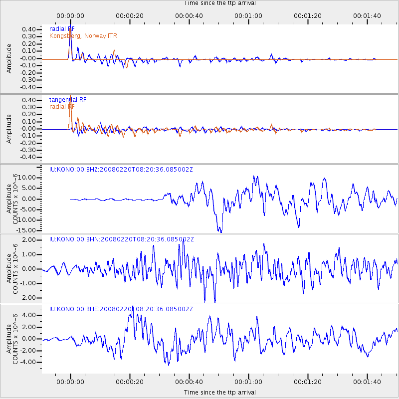
Earthquake location: Off W Coast Of Northern Sumatra
Earthquake latitude/longitude: 2.8/96.0
Earthquake time(UTC): 2008/02/20 (051) 08:08:30 GMT
Earthquake Depth: 26 km
Earthquake Magnitude: 6.5 MB, 7.5 MS, 7.4 MW, 7.4 MW
Earthquake Catalog/Contributor: WHDF/NEIC
Network: IU Global Seismograph Network (GSN - IRIS/USGS)
Station: KONO Kongsberg, Norway
Lat/Lon: 59.65 N/9.60 E
Elevation: 216 m
Distance: 85.8 deg
Az: 329.458 deg
Baz: 91.734 deg
Ray Param: 0.044485565
Estimated Moho Depth: 33.5 km
Estimated Crust Vp/Vs: 1.79
Assumed Crust Vp: 6.545 km/s
Estimated Crust Vs: 3.667 km/s
Estimated Crust Poisson's Ratio: 0.27
Radial Match: 96.91566 %
Radial Bump: 313
Transverse Match: 89.80847 %
Transverse Bump: 400
SOD ConfigId: 2564
Insert Time: 2010-03-04 15:52:39.113 +0000
GWidth: 2.5
Max Bumps: 400
Tol: 0.001

Signal To Noise

ChannelStoNSTALTA
IU:KONO:00:BHN:20080220T08:20:36.085002Z1.23486242.0277479E-71.642084E-7
IU:KONO:00:BHE:20080220T08:20:36.085002Z4.8273436.3484566E-71.3151038E-7
IU:KONO:00:BHZ:20080220T08:20:36.085002Z6.53612331.579638E-62.4167812E-7
Arrivals
Ps4.1 SECOND
PpPs14 SECOND
PsPs/PpSs18 SECOND