You are here: Home > Network List > TA - USArray Transportable Network (new EarthScope stations) Stations List
> Station L04D Klamath Falls, OR, USA > Earthquake Result Viewer
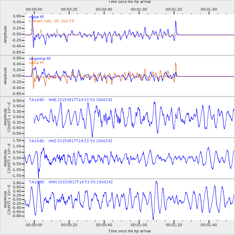
L04D Klamath Falls, OR, USA - Earthquake Result Viewer
*The percent match for this event was below the threshold and hence no stack was calculated.
| Earthquake location: |
Mariana Islands Region |
| Earthquake latitude/longitude: |
21.9/146.6 |
| Earthquake time(UTC): |
2015/08/17 (229) 14:42:32 GMT |
| Earthquake Depth: |
3.1 km |
| Earthquake Magnitude: |
5.6 MWB |
| Earthquake Catalog/Contributor: |
NEIC PDE/NEIC COMCAT |
|
| Network: |
TA USArray Transportable Network (new EarthScope stations) |
| Station: |
L04D Klamath Falls, OR, USA |
| Lat/Lon: |
42.22 N/122.30 W |
| Elevation: |
1437 m |
|
| Distance: |
76.4 deg |
| Az: |
49.844 deg |
| Baz: |
287.193 deg |
| Ray Param: |
$rayparam |
*The percent match for this event was below the threshold and hence was not used in the summary stack. |
|
| Radial Match: |
41.69884 % |
| Radial Bump: |
400 |
| Transverse Match: |
53.27205 % |
| Transverse Bump: |
400 |
| SOD ConfigId: |
7422571 |
| Insert Time: |
2019-04-20 12:09:20.648 +0000 |
| GWidth: |
2.5 |
| Max Bumps: |
400 |
| Tol: |
0.001 |
|
Signal To Noise
| Channel | StoN | STA | LTA |
| TA:L04D: :HHZ:20150817T14:53:50.290024Z | 2.4635823 | 6.231917E-7 | 2.529616E-7 |
| TA:L04D: :HHN:20150817T14:53:50.290024Z | 2.82525 | 5.1264016E-7 | 1.814495E-7 |
| TA:L04D: :HHE:20150817T14:53:50.290024Z | 1.9943815 | 5.5505143E-7 | 2.7830754E-7 |
| Arrivals |
| Ps | |
| PpPs | |
| PsPs/PpSs | |


