You are here: Home > Network List > TA - USArray Transportable Network (new EarthScope stations) Stations List
> Station MDND Maddock, ND, USA > Earthquake Result Viewer
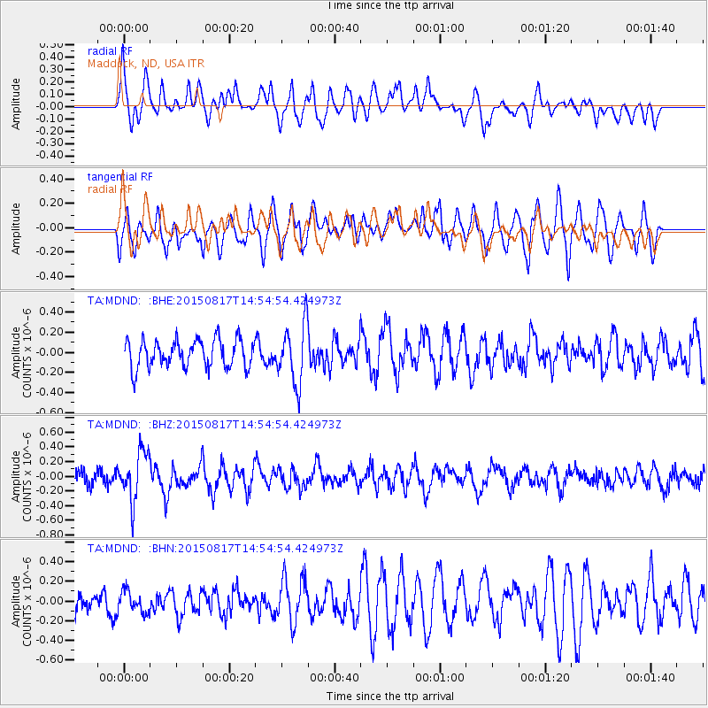
MDND Maddock, ND, USA - Earthquake Result Viewer
*The percent match for this event was below the threshold and hence no stack was calculated.
| Earthquake location: |
Mariana Islands Region |
| Earthquake latitude/longitude: |
21.9/146.6 |
| Earthquake time(UTC): |
2015/08/17 (229) 14:42:32 GMT |
| Earthquake Depth: |
3.1 km |
| Earthquake Magnitude: |
5.6 MWB |
| Earthquake Catalog/Contributor: |
NEIC PDE/NEIC COMCAT |
|
| Network: |
TA USArray Transportable Network (new EarthScope stations) |
| Station: |
MDND Maddock, ND, USA |
| Lat/Lon: |
47.85 N/99.60 W |
| Elevation: |
479 m |
|
| Distance: |
88.7 deg |
| Az: |
38.074 deg |
| Baz: |
301.782 deg |
| Ray Param: |
$rayparam |
*The percent match for this event was below the threshold and hence was not used in the summary stack. |
|
| Radial Match: |
59.13913 % |
| Radial Bump: |
400 |
| Transverse Match: |
58.22044 % |
| Transverse Bump: |
400 |
| SOD ConfigId: |
7422571 |
| Insert Time: |
2019-04-20 12:09:27.860 +0000 |
| GWidth: |
2.5 |
| Max Bumps: |
400 |
| Tol: |
0.001 |
|
Signal To Noise
| Channel | StoN | STA | LTA |
| TA:MDND: :BHZ:20150817T14:54:54.424973Z | 3.9340127 | 3.36273E-7 | 8.547837E-8 |
| TA:MDND: :BHN:20150817T14:54:54.424973Z | 0.9136909 | 1.0966792E-7 | 1.2002737E-7 |
| TA:MDND: :BHE:20150817T14:54:54.424973Z | 2.1426005 | 2.9893346E-7 | 1.3951899E-7 |
| Arrivals |
| Ps | |
| PpPs | |
| PsPs/PpSs | |


