You are here: Home > Network List > TA - USArray Transportable Network (new EarthScope stations) Stations List
> Station R11A Troy Canyon, Currant, NV, USA > Earthquake Result Viewer
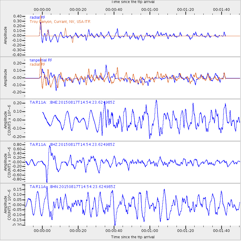
R11A Troy Canyon, Currant, NV, USA - Earthquake Result Viewer
*The percent match for this event was below the threshold and hence no stack was calculated.
| Earthquake location: |
Mariana Islands Region |
| Earthquake latitude/longitude: |
21.9/146.6 |
| Earthquake time(UTC): |
2015/08/17 (229) 14:42:32 GMT |
| Earthquake Depth: |
3.1 km |
| Earthquake Magnitude: |
5.6 MWB |
| Earthquake Catalog/Contributor: |
NEIC PDE/NEIC COMCAT |
|
| Network: |
TA USArray Transportable Network (new EarthScope stations) |
| Station: |
R11A Troy Canyon, Currant, NV, USA |
| Lat/Lon: |
38.35 N/115.59 W |
| Elevation: |
1756 m |
|
| Distance: |
82.5 deg |
| Az: |
51.794 deg |
| Baz: |
291.885 deg |
| Ray Param: |
$rayparam |
*The percent match for this event was below the threshold and hence was not used in the summary stack. |
|
| Radial Match: |
63.09102 % |
| Radial Bump: |
400 |
| Transverse Match: |
64.22671 % |
| Transverse Bump: |
400 |
| SOD ConfigId: |
7422571 |
| Insert Time: |
2019-04-20 12:09:39.614 +0000 |
| GWidth: |
2.5 |
| Max Bumps: |
400 |
| Tol: |
0.001 |
|
Signal To Noise
| Channel | StoN | STA | LTA |
| TA:R11A: :BHZ:20150817T14:54:23.624985Z | 6.733455 | 4.4225155E-7 | 6.5679735E-8 |
| TA:R11A: :BHN:20150817T14:54:23.624985Z | 1.6343169 | 9.065048E-8 | 5.5466888E-8 |
| TA:R11A: :BHE:20150817T14:54:23.624985Z | 2.1500049 | 1.1661663E-7 | 5.4240168E-8 |
| Arrivals |
| Ps | |
| PpPs | |
| PsPs/PpSs | |


