You are here: Home > Network List > US - United States National Seismic Network Stations List
> Station DGMT Dagmar, Montana, USA > Earthquake Result Viewer
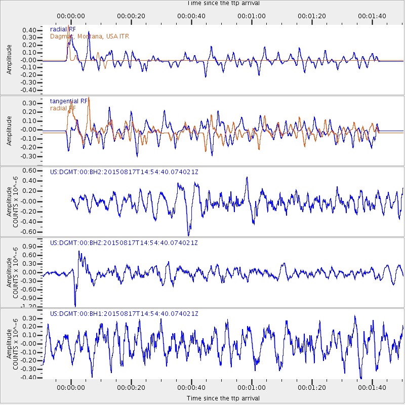
DGMT Dagmar, Montana, USA - Earthquake Result Viewer
*The percent match for this event was below the threshold and hence no stack was calculated.
| Earthquake location: |
Mariana Islands Region |
| Earthquake latitude/longitude: |
21.9/146.6 |
| Earthquake time(UTC): |
2015/08/17 (229) 14:42:32 GMT |
| Earthquake Depth: |
3.1 km |
| Earthquake Magnitude: |
5.6 MWB |
| Earthquake Catalog/Contributor: |
NEIC PDE/NEIC COMCAT |
|
| Network: |
US United States National Seismic Network |
| Station: |
DGMT Dagmar, Montana, USA |
| Lat/Lon: |
48.47 N/104.20 W |
| Elevation: |
0.0 m |
|
| Distance: |
85.7 deg |
| Az: |
39.078 deg |
| Baz: |
298.419 deg |
| Ray Param: |
$rayparam |
*The percent match for this event was below the threshold and hence was not used in the summary stack. |
|
| Radial Match: |
55.77604 % |
| Radial Bump: |
400 |
| Transverse Match: |
59.819782 % |
| Transverse Bump: |
400 |
| SOD ConfigId: |
7422571 |
| Insert Time: |
2019-04-20 12:10:19.154 +0000 |
| GWidth: |
2.5 |
| Max Bumps: |
400 |
| Tol: |
0.001 |
|
Signal To Noise
| Channel | StoN | STA | LTA |
| US:DGMT:00:BHZ:20150817T14:54:40.074021Z | 7.306255 | 4.672635E-7 | 6.3953905E-8 |
| US:DGMT:00:BH1:20150817T14:54:40.074021Z | 0.7798399 | 1.0673018E-7 | 1.3686166E-7 |
| US:DGMT:00:BH2:20150817T14:54:40.074021Z | 1.6379904 | 1.8301363E-7 | 1.11730586E-7 |
| Arrivals |
| Ps | |
| PpPs | |
| PsPs/PpSs | |


