You are here: Home > Network List > US - United States National Seismic Network Stations List
> Station LAO LASA Array, Montana, USA > Earthquake Result Viewer
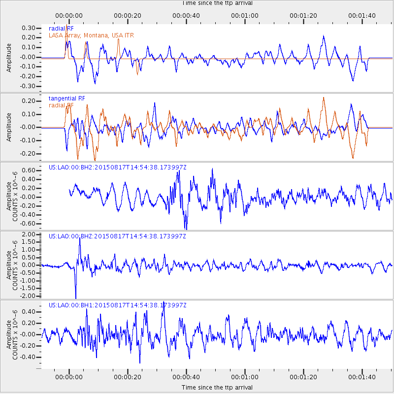
LAO LASA Array, Montana, USA - Earthquake Result Viewer
*The percent match for this event was below the threshold and hence no stack was calculated.
| Earthquake location: |
Mariana Islands Region |
| Earthquake latitude/longitude: |
21.9/146.6 |
| Earthquake time(UTC): |
2015/08/17 (229) 14:42:32 GMT |
| Earthquake Depth: |
3.1 km |
| Earthquake Magnitude: |
5.6 MWB |
| Earthquake Catalog/Contributor: |
NEIC PDE/NEIC COMCAT |
|
| Network: |
US United States National Seismic Network |
| Station: |
LAO LASA Array, Montana, USA |
| Lat/Lon: |
46.69 N/106.22 W |
| Elevation: |
902 m |
|
| Distance: |
85.4 deg |
| Az: |
41.302 deg |
| Baz: |
297.099 deg |
| Ray Param: |
$rayparam |
*The percent match for this event was below the threshold and hence was not used in the summary stack. |
|
| Radial Match: |
57.115284 % |
| Radial Bump: |
400 |
| Transverse Match: |
67.95891 % |
| Transverse Bump: |
400 |
| SOD ConfigId: |
7422571 |
| Insert Time: |
2019-04-20 12:10:22.153 +0000 |
| GWidth: |
2.5 |
| Max Bumps: |
400 |
| Tol: |
0.001 |
|
Signal To Noise
| Channel | StoN | STA | LTA |
| US:LAO:00:BHZ:20150817T14:54:38.173997Z | 6.5203123 | 6.9897885E-7 | 1.07200215E-7 |
| US:LAO:00:BH1:20150817T14:54:38.173997Z | 1.0473632 | 9.740953E-8 | 9.300454E-8 |
| US:LAO:00:BH2:20150817T14:54:38.173997Z | 0.9626659 | 1.5692686E-7 | 1.6301279E-7 |
| Arrivals |
| Ps | |
| PpPs | |
| PsPs/PpSs | |


