You are here: Home > Network List > UW - Pacific Northwest Regional Seismic Network Stations List
> Station LON Longmire CREST broad-band > Earthquake Result Viewer
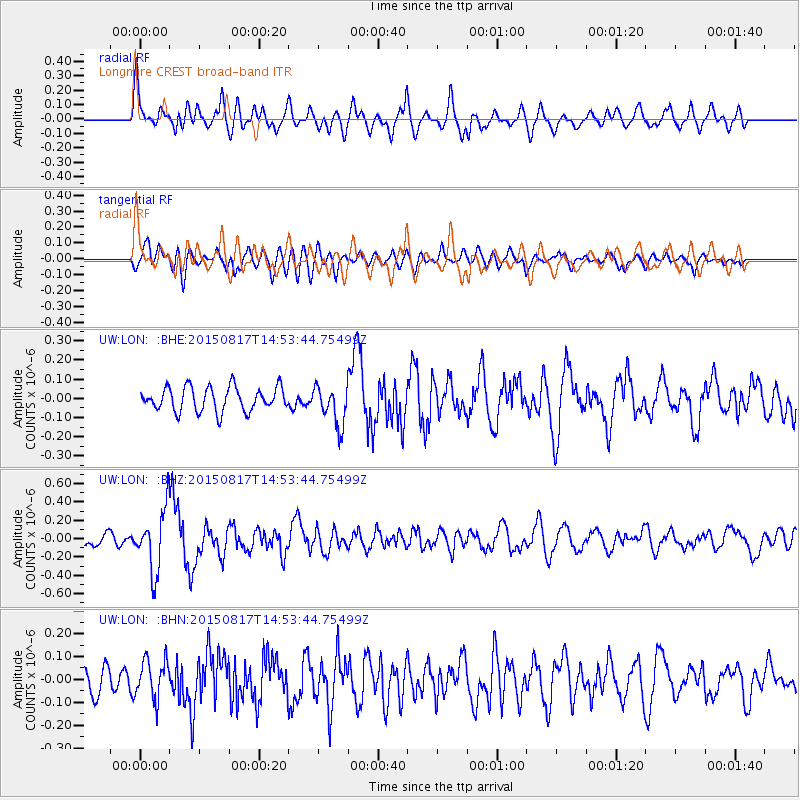
LON Longmire CREST broad-band - Earthquake Result Viewer
*The percent match for this event was below the threshold and hence no stack was calculated.
| Earthquake location: |
Mariana Islands Region |
| Earthquake latitude/longitude: |
21.9/146.6 |
| Earthquake time(UTC): |
2015/08/17 (229) 14:42:32 GMT |
| Earthquake Depth: |
3.1 km |
| Earthquake Magnitude: |
5.6 MWB |
| Earthquake Catalog/Contributor: |
NEIC PDE/NEIC COMCAT |
|
| Network: |
UW Pacific Northwest Regional Seismic Network |
| Station: |
LON Longmire CREST broad-band |
| Lat/Lon: |
46.75 N/121.81 W |
| Elevation: |
853 m |
|
| Distance: |
75.4 deg |
| Az: |
45.264 deg |
| Baz: |
286.421 deg |
| Ray Param: |
$rayparam |
*The percent match for this event was below the threshold and hence was not used in the summary stack. |
|
| Radial Match: |
74.26436 % |
| Radial Bump: |
400 |
| Transverse Match: |
59.41969 % |
| Transverse Bump: |
400 |
| SOD ConfigId: |
7422571 |
| Insert Time: |
2019-04-20 12:10:39.633 +0000 |
| GWidth: |
2.5 |
| Max Bumps: |
400 |
| Tol: |
0.001 |
|
Signal To Noise
| Channel | StoN | STA | LTA |
| UW:LON: :BHZ:20150817T14:53:44.75499Z | 5.6393805 | 3.4122402E-7 | 6.050736E-8 |
| UW:LON: :BHN:20150817T14:53:44.75499Z | 1.4163375 | 8.354545E-8 | 5.8986966E-8 |
| UW:LON: :BHE:20150817T14:53:44.75499Z | 1.8396719 | 1.1578025E-7 | 6.293528E-8 |
| Arrivals |
| Ps | |
| PpPs | |
| PsPs/PpSs | |


