You are here: Home > Network List > AV - Alaska Volcano Observatory Stations List
> Station SPCR Ckakachatna River, Mount Spurr, Alaska > Earthquake Result Viewer
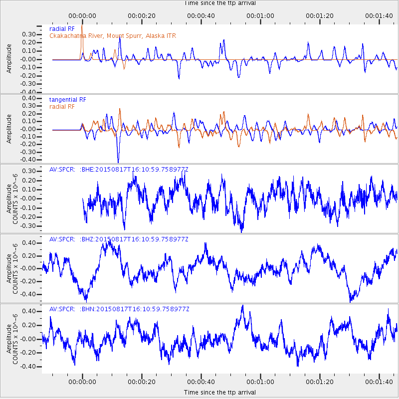
SPCR Ckakachatna River, Mount Spurr, Alaska - Earthquake Result Viewer
*The percent match for this event was below the threshold and hence no stack was calculated.
| Earthquake location: |
Kermadec Islands Region |
| Earthquake latitude/longitude: |
-27.1/-176.1 |
| Earthquake time(UTC): |
2015/08/17 (229) 15:58:31 GMT |
| Earthquake Depth: |
10 km |
| Earthquake Magnitude: |
4.9 mb |
| Earthquake Catalog/Contributor: |
ISC/ISC |
|
| Network: |
AV Alaska Volcano Observatory |
| Station: |
SPCR Ckakachatna River, Mount Spurr, Alaska |
| Lat/Lon: |
61.20 N/152.21 W |
| Elevation: |
984 m |
|
| Distance: |
90.1 deg |
| Az: |
11.297 deg |
| Baz: |
201.142 deg |
| Ray Param: |
$rayparam |
*The percent match for this event was below the threshold and hence was not used in the summary stack. |
|
| Radial Match: |
47.97013 % |
| Radial Bump: |
400 |
| Transverse Match: |
42.88363 % |
| Transverse Bump: |
400 |
| SOD ConfigId: |
7422571 |
| Insert Time: |
2019-04-20 12:15:22.039 +0000 |
| GWidth: |
2.5 |
| Max Bumps: |
400 |
| Tol: |
0.001 |
|
Signal To Noise
| Channel | StoN | STA | LTA |
| AV:SPCR: :BHZ:20150817T16:10:59.758977Z | 2.5161805 | 3.4399048E-7 | 1.3671136E-7 |
| AV:SPCR: :BHN:20150817T16:10:59.758977Z | 0.741472 | 1.0170462E-7 | 1.3716583E-7 |
| AV:SPCR: :BHE:20150817T16:10:59.758977Z | 1.4596183 | 1.7600551E-7 | 1.2058325E-7 |
| Arrivals |
| Ps | |
| PpPs | |
| PsPs/PpSs | |


