KONO Kongsberg, Norway - Earthquake Result Viewer
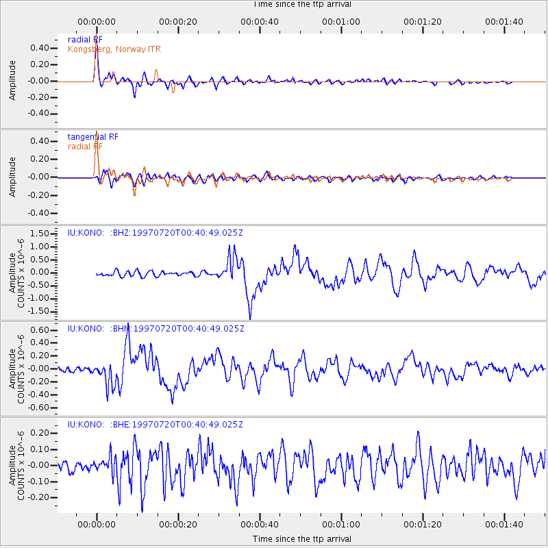
Earthquake location: Fox Islands, Aleutian Islands
Earthquake latitude/longitude: 52.6/-167.5
Earthquake time(UTC): 1997/07/20 (201) 00:30:20 GMT
Earthquake Depth: 14 km
Earthquake Magnitude: 5.6 MB, 5.9 MS, 6.2 UNKNOWN, 6.2 MW
Earthquake Catalog/Contributor: WHDF/NEIC
Network: IU Global Seismograph Network (GSN - IRIS/USGS)
Station: KONO Kongsberg, Norway
Lat/Lon: 59.65 N/9.60 E
Elevation: 216 m
Distance: 68.1 deg
Az: 1.596 deg
Baz: 358.081 deg
Ray Param: 0.056504935
Estimated Moho Depth: 30.75 km
Estimated Crust Vp/Vs: 1.61
Assumed Crust Vp: 6.545 km/s
Estimated Crust Vs: 4.065 km/s
Estimated Crust Poisson's Ratio: 0.19
Radial Match: 94.74632 %
Radial Bump: 400
Transverse Match: 80.50244 %
Transverse Bump: 400
SOD ConfigId: 6273
Insert Time: 2010-03-04 15:55:50.836 +0000
GWidth: 2.5
Max Bumps: 400
Tol: 0.001

Signal To Noise

ChannelStoNSTALTA
IU:KONO: :BHN:19970720T00:40:49.025Z5.9191181.8662463E-73.152913E-8
IU:KONO: :BHE:19970720T00:40:49.025Z1.42214764.9920956E-83.5102513E-8
IU:KONO: :BHZ:19970720T00:40:49.025Z5.33463344.7326978E-78.871646E-8
Arrivals
Ps3.0 SECOND
PpPs12 SECOND
PsPs/PpSs15 SECOND