You are here: Home > Network List > CI - Caltech Regional Seismic Network Stations List
> Station GLA Glamis, Glamis, CA, USA > Earthquake Result Viewer
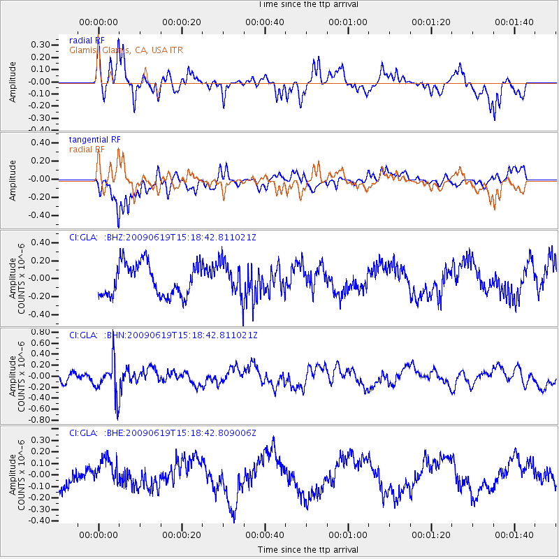
GLA Glamis, Glamis, CA, USA - Earthquake Result Viewer
*The percent match for this event was below the threshold and hence no stack was calculated.
| Earthquake location: |
Mariana Islands |
| Earthquake latitude/longitude: |
14.1/145.2 |
| Earthquake time(UTC): |
2009/06/19 (170) 15:06:24 GMT |
| Earthquake Depth: |
114 km |
| Earthquake Magnitude: |
5.5 MB, 5.5 MW |
| Earthquake Catalog/Contributor: |
WHDF/NEIC |
|
| Network: |
CI Caltech Regional Seismic Network |
| Station: |
GLA Glamis, Glamis, CA, USA |
| Lat/Lon: |
33.05 N/114.83 W |
| Elevation: |
610 m |
|
| Distance: |
90.6 deg |
| Az: |
55.81 deg |
| Baz: |
287.115 deg |
| Ray Param: |
$rayparam |
*The percent match for this event was below the threshold and hence was not used in the summary stack. |
|
| Radial Match: |
67.53174 % |
| Radial Bump: |
392 |
| Transverse Match: |
81.76378 % |
| Transverse Bump: |
400 |
| SOD ConfigId: |
2648 |
| Insert Time: |
2010-02-25 23:38:29.253 +0000 |
| GWidth: |
2.5 |
| Max Bumps: |
400 |
| Tol: |
0.001 |
|
Signal To Noise
| Channel | StoN | STA | LTA |
| CI:GLA: :BHN:20090619T15:18:42.811021Z | 3.6997507 | 3.2355862E-7 | 8.745417E-8 |
| CI:GLA: :BHE:20090619T15:18:42.809006Z | 1.641963 | 1.17282035E-7 | 7.142794E-8 |
| CI:GLA: :BHZ:20090619T15:18:42.811021Z | 1.0862138 | 1.9256503E-7 | 1.7728095E-7 |
| Arrivals |
| Ps | |
| PpPs | |
| PsPs/PpSs | |


