You are here: Home > Network List > AV - Alaska Volcano Observatory Stations List
> Station SPCR Ckakachatna River, Mount Spurr, Alaska > Earthquake Result Viewer
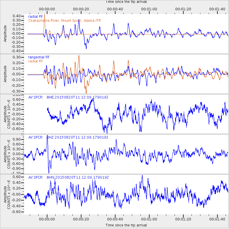
SPCR Ckakachatna River, Mount Spurr, Alaska - Earthquake Result Viewer
*The percent match for this event was below the threshold and hence no stack was calculated.
| Earthquake location: |
Northern Molucca Sea |
| Earthquake latitude/longitude: |
0.5/126.6 |
| Earthquake time(UTC): |
2015/08/20 (232) 11:00:10 GMT |
| Earthquake Depth: |
50 km |
| Earthquake Magnitude: |
5.7 MB |
| Earthquake Catalog/Contributor: |
NEIC PDE/NEIC COMCAT |
|
| Network: |
AV Alaska Volcano Observatory |
| Station: |
SPCR Ckakachatna River, Mount Spurr, Alaska |
| Lat/Lon: |
61.20 N/152.21 W |
| Elevation: |
984 m |
|
| Distance: |
85.3 deg |
| Az: |
28.693 deg |
| Baz: |
262.505 deg |
| Ray Param: |
$rayparam |
*The percent match for this event was below the threshold and hence was not used in the summary stack. |
|
| Radial Match: |
44.42049 % |
| Radial Bump: |
400 |
| Transverse Match: |
53.07224 % |
| Transverse Bump: |
400 |
| SOD ConfigId: |
7422571 |
| Insert Time: |
2019-04-20 12:30:56.583 +0000 |
| GWidth: |
2.5 |
| Max Bumps: |
400 |
| Tol: |
0.001 |
|
Signal To Noise
| Channel | StoN | STA | LTA |
| AV:SPCR: :BHZ:20150820T11:12:09.179019Z | 3.971898 | 5.834456E-7 | 1.4689341E-7 |
| AV:SPCR: :BHN:20150820T11:12:09.179019Z | 1.3019485 | 2.0908669E-7 | 1.6059522E-7 |
| AV:SPCR: :BHE:20150820T11:12:09.179019Z | 2.036781 | 4.672482E-7 | 2.2940523E-7 |
| Arrivals |
| Ps | |
| PpPs | |
| PsPs/PpSs | |


