KONO Kongsberg, Norway - Earthquake Result Viewer
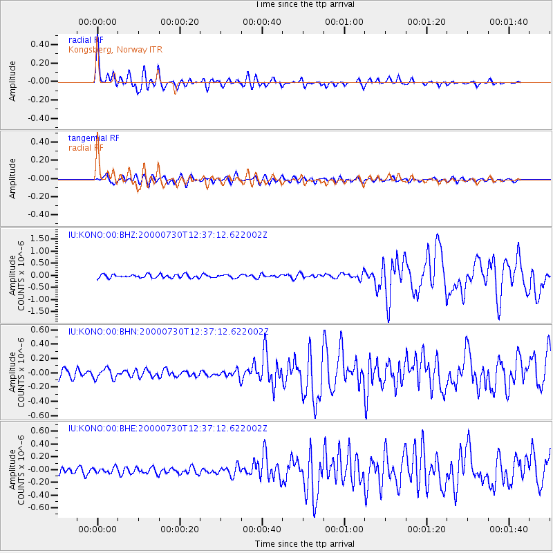
Earthquake location: Southeast Of Honshu, Japan
Earthquake latitude/longitude: 33.9/139.4
Earthquake time(UTC): 2000/07/30 (212) 12:25:45 GMT
Earthquake Depth: 10 km
Earthquake Magnitude: 6.0 MB, 6.5 MS, 6.5 MW, 6.5 MW
Earthquake Catalog/Contributor: WHDF/NEIC
Network: IU Global Seismograph Network (GSN - IRIS/USGS)
Station: KONO Kongsberg, Norway
Lat/Lon: 59.65 N/9.60 E
Elevation: 216 m
Distance: 78.0 deg
Az: 336.484 deg
Baz: 40.807 deg
Ray Param: 0.049944427
Estimated Moho Depth: 18.0 km
Estimated Crust Vp/Vs: 1.90
Assumed Crust Vp: 6.545 km/s
Estimated Crust Vs: 3.44 km/s
Estimated Crust Poisson's Ratio: 0.31
Radial Match: 94.494865 %
Radial Bump: 400
Transverse Match: 78.99117 %
Transverse Bump: 400
SOD ConfigId: 3744
Insert Time: 2010-03-04 15:56:53.149 +0000
GWidth: 2.5
Max Bumps: 400
Tol: 0.001

Signal To Noise

ChannelStoNSTALTA
IU:KONO:00:BHN:20000730T12:37:12.622002Z1.2808727.421312E-85.7939527E-8
IU:KONO:00:BHE:20000730T12:37:12.622002Z1.20579374.3462162E-83.6044444E-8
IU:KONO:00:BHZ:20000730T12:37:12.622002Z0.836291735.886134E-87.0383734E-8
Arrivals
Ps2.6 SECOND
PpPs7.8 SECOND
PsPs/PpSs10 SECOND