
KONO Kongsberg, Norway - Earthquake Result Viewer
| ||||||||||||||||||
| ||||||||||||||||||
| ||||||||||||||||||
|
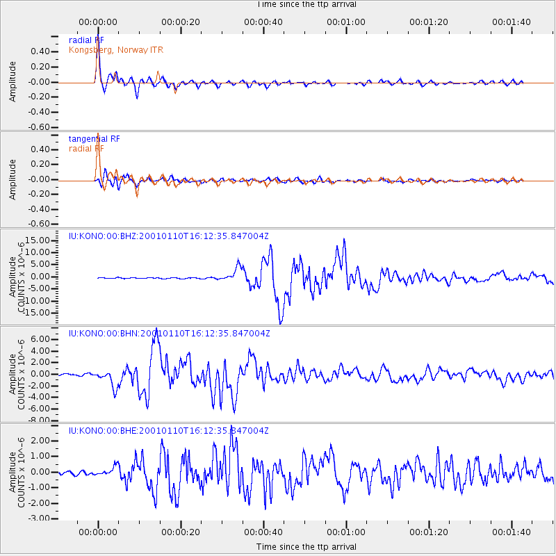
Signal To Noise
| Channel | StoN | STA | LTA |
| IU:KONO:00:BHN:20010110T16:12:35.847004Z | 11.760118 | 1.5167278E-6 | 1.2897218E-7 |
| IU:KONO:00:BHE:20010110T16:12:35.847004Z | 3.467749 | 3.1153382E-7 | 8.983747E-8 |
| IU:KONO:00:BHZ:20010110T16:12:35.847004Z | 17.015865 | 2.999177E-6 | 1.762577E-7 |
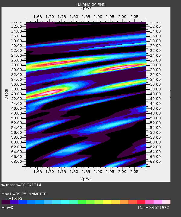
| Arrivals | |
| Ps | 4.4 SECOND |
| PpPs | 15 SECOND |
| PsPs/PpSs | 20 SECOND |

