You are here: Home > Network List > TA - USArray Transportable Network (new EarthScope stations) Stations List
> Station J01E Myrtle Point, OR, USA > Earthquake Result Viewer
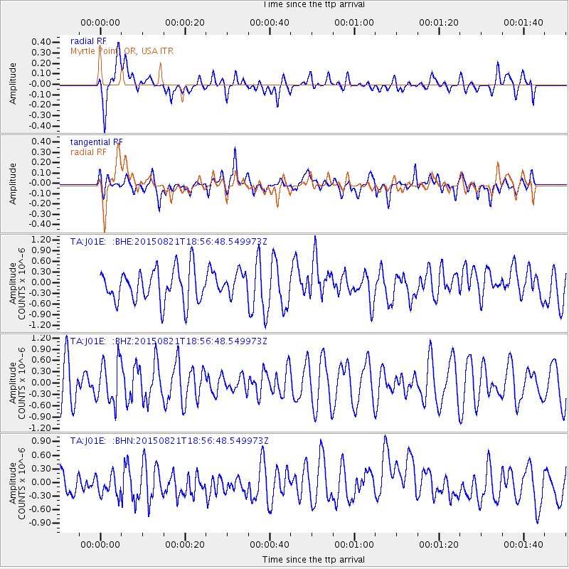
J01E Myrtle Point, OR, USA - Earthquake Result Viewer
*The percent match for this event was below the threshold and hence no stack was calculated.
| Earthquake location: |
South Of Fiji Islands |
| Earthquake latitude/longitude: |
-22.4/-178.2 |
| Earthquake time(UTC): |
2015/08/21 (233) 18:45:39 GMT |
| Earthquake Depth: |
370 km |
| Earthquake Magnitude: |
5.3 MW |
| Earthquake Catalog/Contributor: |
ISC/ISC |
|
| Network: |
TA USArray Transportable Network (new EarthScope stations) |
| Station: |
J01E Myrtle Point, OR, USA |
| Lat/Lon: |
43.16 N/123.93 W |
| Elevation: |
128 m |
|
| Distance: |
82.1 deg |
| Az: |
36.836 deg |
| Baz: |
229.32 deg |
| Ray Param: |
$rayparam |
*The percent match for this event was below the threshold and hence was not used in the summary stack. |
|
| Radial Match: |
55.10957 % |
| Radial Bump: |
400 |
| Transverse Match: |
43.87953 % |
| Transverse Bump: |
400 |
| SOD ConfigId: |
7422571 |
| Insert Time: |
2019-04-20 12:46:28.322 +0000 |
| GWidth: |
2.5 |
| Max Bumps: |
400 |
| Tol: |
0.001 |
|
Signal To Noise
| Channel | StoN | STA | LTA |
| TA:J01E: :BHZ:20150821T18:56:48.549973Z | 0.842409 | 5.6043706E-7 | 6.6527906E-7 |
| TA:J01E: :BHN:20150821T18:56:48.549973Z | 0.7767781 | 3.25244E-7 | 4.1870905E-7 |
| TA:J01E: :BHE:20150821T18:56:48.549973Z | 0.70421076 | 3.2317772E-7 | 4.5892187E-7 |
| Arrivals |
| Ps | |
| PpPs | |
| PsPs/PpSs | |


