You are here: Home > Network List > TA - USArray Transportable Network (new EarthScope stations) Stations List
> Station J05D Fort Rock, OR, USA > Earthquake Result Viewer
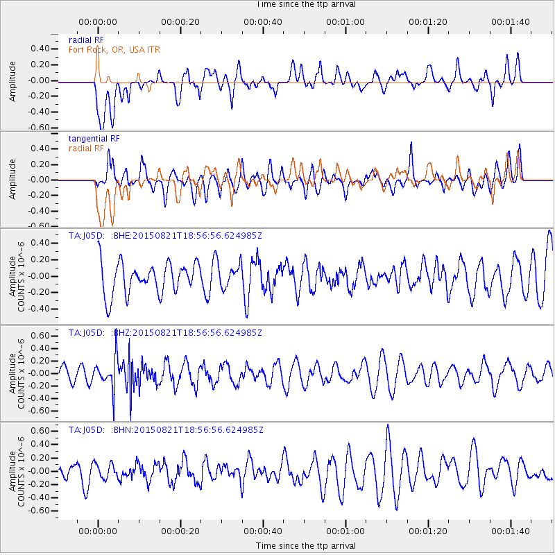
J05D Fort Rock, OR, USA - Earthquake Result Viewer
*The percent match for this event was below the threshold and hence no stack was calculated.
| Earthquake location: |
South Of Fiji Islands |
| Earthquake latitude/longitude: |
-22.4/-178.2 |
| Earthquake time(UTC): |
2015/08/21 (233) 18:45:39 GMT |
| Earthquake Depth: |
370 km |
| Earthquake Magnitude: |
5.3 MW |
| Earthquake Catalog/Contributor: |
ISC/ISC |
|
| Network: |
TA USArray Transportable Network (new EarthScope stations) |
| Station: |
J05D Fort Rock, OR, USA |
| Lat/Lon: |
43.28 N/121.23 W |
| Elevation: |
1541 m |
|
| Distance: |
83.7 deg |
| Az: |
38.009 deg |
| Baz: |
231.306 deg |
| Ray Param: |
$rayparam |
*The percent match for this event was below the threshold and hence was not used in the summary stack. |
|
| Radial Match: |
40.389935 % |
| Radial Bump: |
400 |
| Transverse Match: |
51.823357 % |
| Transverse Bump: |
400 |
| SOD ConfigId: |
7422571 |
| Insert Time: |
2019-04-20 12:46:28.982 +0000 |
| GWidth: |
2.5 |
| Max Bumps: |
400 |
| Tol: |
0.001 |
|
Signal To Noise
| Channel | StoN | STA | LTA |
| TA:J05D: :BHZ:20150821T18:56:56.624985Z | 1.8934364 | 2.4890306E-7 | 1.3145574E-7 |
| TA:J05D: :BHN:20150821T18:56:56.624985Z | 0.5025448 | 1.2291531E-7 | 2.4458575E-7 |
| TA:J05D: :BHE:20150821T18:56:56.624985Z | 0.70295954 | 1.3465059E-7 | 1.9154814E-7 |
| Arrivals |
| Ps | |
| PpPs | |
| PsPs/PpSs | |


