You are here: Home > Network List > US - United States National Seismic Network Stations List
> Station MNTX Cornudas Mountains, Texas, USA > Earthquake Result Viewer
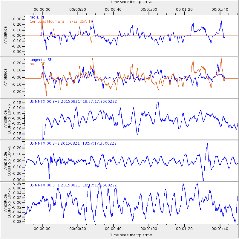
MNTX Cornudas Mountains, Texas, USA - Earthquake Result Viewer
*The percent match for this event was below the threshold and hence no stack was calculated.
| Earthquake location: |
South Of Fiji Islands |
| Earthquake latitude/longitude: |
-22.4/-178.2 |
| Earthquake time(UTC): |
2015/08/21 (233) 18:45:39 GMT |
| Earthquake Depth: |
370 km |
| Earthquake Magnitude: |
5.3 MW |
| Earthquake Catalog/Contributor: |
ISC/ISC |
|
| Network: |
US United States National Seismic Network |
| Station: |
MNTX Cornudas Mountains, Texas, USA |
| Lat/Lon: |
31.70 N/105.38 W |
| Elevation: |
404 m |
|
| Distance: |
88.0 deg |
| Az: |
54.564 deg |
| Baz: |
242.216 deg |
| Ray Param: |
$rayparam |
*The percent match for this event was below the threshold and hence was not used in the summary stack. |
|
| Radial Match: |
36.477028 % |
| Radial Bump: |
400 |
| Transverse Match: |
35.72051 % |
| Transverse Bump: |
400 |
| SOD ConfigId: |
7422571 |
| Insert Time: |
2019-04-20 12:47:18.751 +0000 |
| GWidth: |
2.5 |
| Max Bumps: |
400 |
| Tol: |
0.001 |
|
Signal To Noise
| Channel | StoN | STA | LTA |
| US:MNTX:00:BHZ:20150821T18:57:17.350022Z | 1.611894 | 7.977855E-8 | 4.949367E-8 |
| US:MNTX:00:BH1:20150821T18:57:17.350022Z | 0.5039328 | 1.9124732E-8 | 3.795096E-8 |
| US:MNTX:00:BH2:20150821T18:57:17.350022Z | 1.1377084 | 6.6136856E-8 | 5.8131636E-8 |
| Arrivals |
| Ps | |
| PpPs | |
| PsPs/PpSs | |


