You are here: Home > Network List > US - United States National Seismic Network Stations List
> Station MSO Missoula, Montana, USA > Earthquake Result Viewer
MSO Missoula, Montana, USA - Earthquake Result Viewer
*The percent match for this event was below the threshold and hence no stack was calculated.
| Earthquake location: |
Near Coast Of Northern Peru |
| Earthquake latitude/longitude: |
-8.3/-79.8 |
| Earthquake time(UTC): |
2015/04/26 (116) 23:35:29 GMT |
| Earthquake Depth: |
22 km |
| Earthquake Magnitude: |
5.6 MWW, 5.6 MWB, 5.7 MWC |
| Earthquake Catalog/Contributor: |
NEIC PDE/NEIC COMCAT |
|
| Network: |
US United States National Seismic Network |
| Station: |
MSO Missoula, Montana, USA |
| Lat/Lon: |
46.83 N/113.94 W |
| Elevation: |
1264 m |
|
| Distance: |
62.7 deg |
| Az: |
334.318 deg |
| Baz: |
141.344 deg |
| Ray Param: |
$rayparam |
*The percent match for this event was below the threshold and hence was not used in the summary stack. |
|
| Radial Match: |
68.423 % |
| Radial Bump: |
400 |
| Transverse Match: |
44.237133 % |
| Transverse Bump: |
400 |
| SOD ConfigId: |
872571 |
| Insert Time: |
2015-05-10 23:52:22.616 +0000 |
| GWidth: |
2.5 |
| Max Bumps: |
400 |
| Tol: |
0.001 |
|
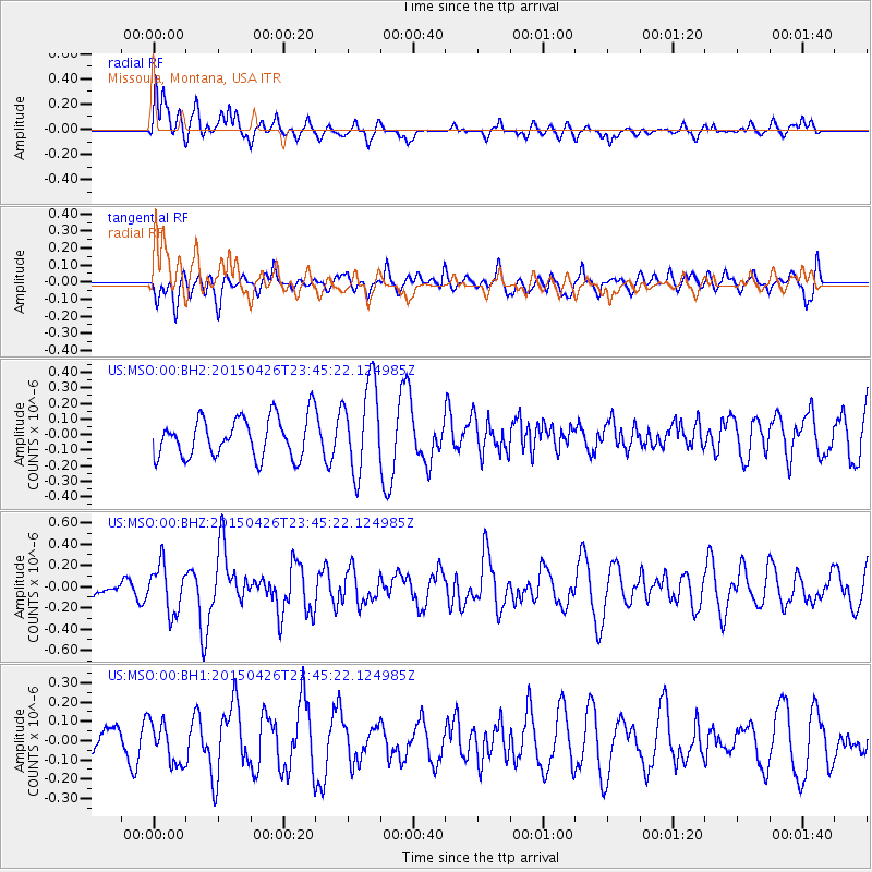
Signal To Noise
| Channel | StoN | STA | LTA |
| US:MSO:00:BHZ:20150426T23:45:22.124985Z | 2.9702005 | 2.2081828E-7 | 7.434457E-8 |
| US:MSO:00:BH1:20150426T23:45:22.124985Z | 0.74526876 | 1.06666036E-7 | 1.4312425E-7 |
| US:MSO:00:BH2:20150426T23:45:22.124985Z | 2.2598228 | 2.8938263E-7 | 1.2805545E-7 |
| Arrivals |
| Ps | |
| PpPs | |
| PsPs/PpSs | |


