You are here: Home > Network List > UU - University of Utah Regional Network Stations List
> Station CCUT Cedar City, UT, USA > Earthquake Result Viewer
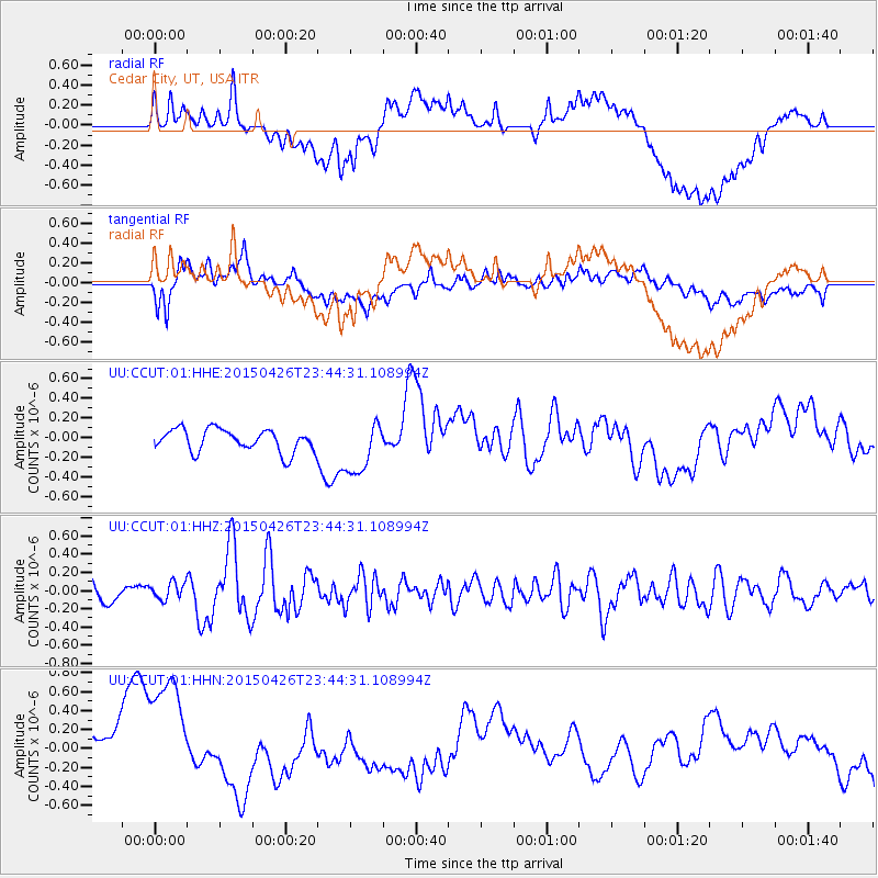
CCUT Cedar City, UT, USA - Earthquake Result Viewer
*The percent match for this event was below the threshold and hence no stack was calculated.
| Earthquake location: |
Near Coast Of Northern Peru |
| Earthquake latitude/longitude: |
-8.3/-79.8 |
| Earthquake time(UTC): |
2015/04/26 (116) 23:35:29 GMT |
| Earthquake Depth: |
22 km |
| Earthquake Magnitude: |
5.6 MWW, 5.6 MWB, 5.7 MWC |
| Earthquake Catalog/Contributor: |
NEIC PDE/NEIC COMCAT |
|
| Network: |
UU University of Utah Regional Network |
| Station: |
CCUT Cedar City, UT, USA |
| Lat/Lon: |
37.55 N/113.36 W |
| Elevation: |
2127 m |
|
| Distance: |
55.4 deg |
| Az: |
327.732 deg |
| Baz: |
138.334 deg |
| Ray Param: |
$rayparam |
*The percent match for this event was below the threshold and hence was not used in the summary stack. |
|
| Radial Match: |
35.17539 % |
| Radial Bump: |
400 |
| Transverse Match: |
56.985645 % |
| Transverse Bump: |
400 |
| SOD ConfigId: |
872571 |
| Insert Time: |
2015-05-10 23:52:46.316 +0000 |
| GWidth: |
2.5 |
| Max Bumps: |
400 |
| Tol: |
0.001 |
|
Signal To Noise
| Channel | StoN | STA | LTA |
| UU:CCUT:01:HHZ:20150426T23:44:31.108994Z | 0.84156203 | 9.534186E-8 | 1.1329154E-7 |
| UU:CCUT:01:HHN:20150426T23:44:31.108994Z | 3.4659479 | 7.498801E-7 | 2.1635643E-7 |
| UU:CCUT:01:HHE:20150426T23:44:31.108994Z | 2.3637938 | 2.7114427E-7 | 1.1470724E-7 |
| Arrivals |
| Ps | |
| PpPs | |
| PsPs/PpSs | |


