You are here: Home > Network List > TA - USArray Transportable Network (new EarthScope stations) Stations List
> Station J01E Myrtle Point, OR, USA > Earthquake Result Viewer
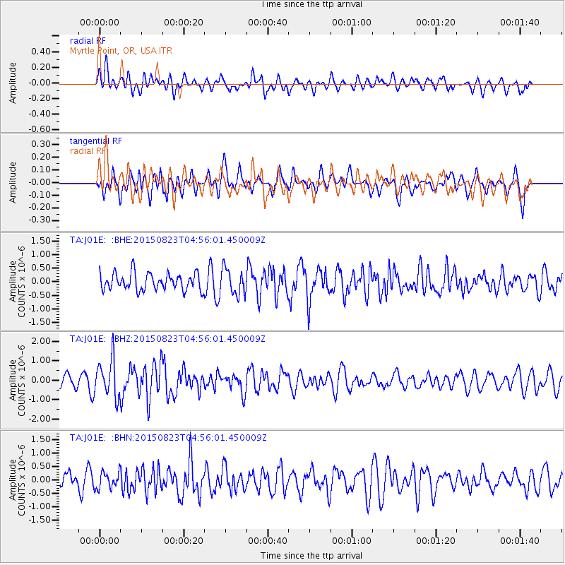
J01E Myrtle Point, OR, USA - Earthquake Result Viewer
*The percent match for this event was below the threshold and hence no stack was calculated.
| Earthquake location: |
Near Coast Of Guatemala |
| Earthquake latitude/longitude: |
13.1/-90.3 |
| Earthquake time(UTC): |
2015/08/23 (235) 04:48:46 GMT |
| Earthquake Depth: |
32 km |
| Earthquake Magnitude: |
5.5 MW |
| Earthquake Catalog/Contributor: |
ISC/ISC |
|
| Network: |
TA USArray Transportable Network (new EarthScope stations) |
| Station: |
J01E Myrtle Point, OR, USA |
| Lat/Lon: |
43.16 N/123.93 W |
| Elevation: |
128 m |
|
| Distance: |
41.7 deg |
| Az: |
322.425 deg |
| Baz: |
125.703 deg |
| Ray Param: |
$rayparam |
*The percent match for this event was below the threshold and hence was not used in the summary stack. |
|
| Radial Match: |
56.79657 % |
| Radial Bump: |
400 |
| Transverse Match: |
63.454662 % |
| Transverse Bump: |
400 |
| SOD ConfigId: |
7422571 |
| Insert Time: |
2019-04-20 13:21:41.611 +0000 |
| GWidth: |
2.5 |
| Max Bumps: |
400 |
| Tol: |
0.001 |
|
Signal To Noise
| Channel | StoN | STA | LTA |
| TA:J01E: :BHZ:20150823T04:56:01.450009Z | 2.9606152 | 9.714802E-7 | 3.2813458E-7 |
| TA:J01E: :BHN:20150823T04:56:01.450009Z | 0.97687405 | 2.9586272E-7 | 3.028668E-7 |
| TA:J01E: :BHE:20150823T04:56:01.450009Z | 1.5615897 | 4.7804053E-7 | 3.061243E-7 |
| Arrivals |
| Ps | |
| PpPs | |
| PsPs/PpSs | |


