You are here: Home > Network List > UW - Pacific Northwest Regional Seismic Network Stations List
> Station HOOD Mt Hood Meadows, OR CREST BB SMO > Earthquake Result Viewer
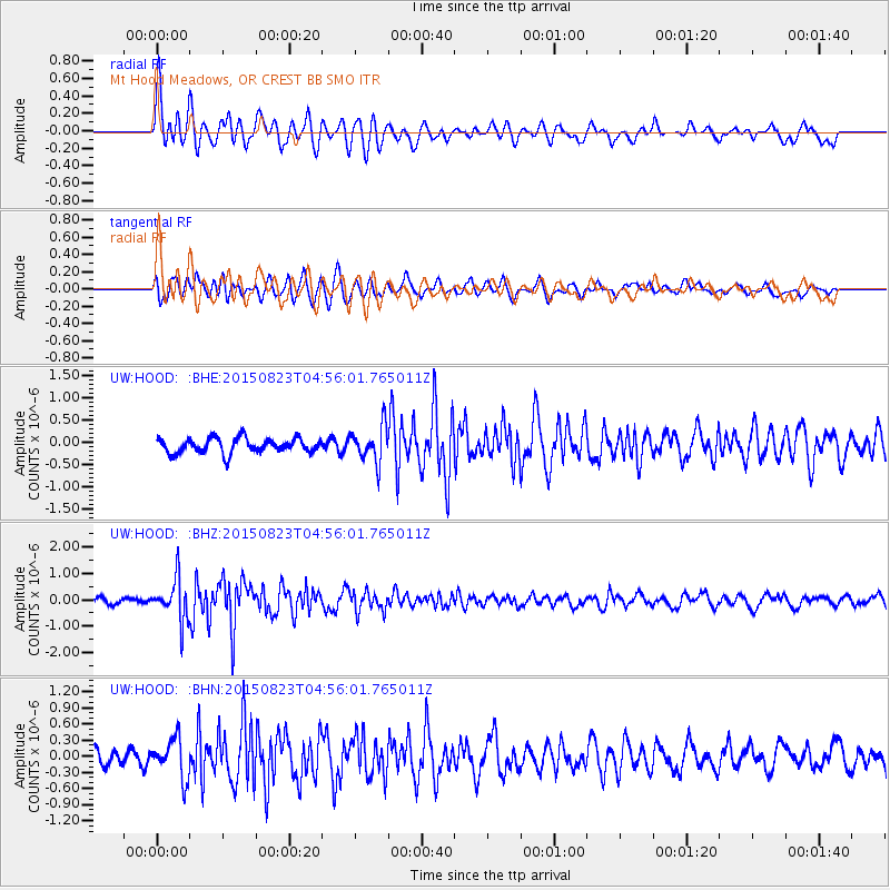
HOOD Mt Hood Meadows, OR CREST BB SMO - Earthquake Result Viewer
*The percent match for this event was below the threshold and hence no stack was calculated.
| Earthquake location: |
Near Coast Of Guatemala |
| Earthquake latitude/longitude: |
13.1/-90.3 |
| Earthquake time(UTC): |
2015/08/23 (235) 04:48:46 GMT |
| Earthquake Depth: |
32 km |
| Earthquake Magnitude: |
5.5 MW |
| Earthquake Catalog/Contributor: |
ISC/ISC |
|
| Network: |
UW Pacific Northwest Regional Seismic Network |
| Station: |
HOOD Mt Hood Meadows, OR CREST BB SMO |
| Lat/Lon: |
45.32 N/121.65 W |
| Elevation: |
1520 m |
|
| Distance: |
41.7 deg |
| Az: |
326.496 deg |
| Baz: |
130.326 deg |
| Ray Param: |
$rayparam |
*The percent match for this event was below the threshold and hence was not used in the summary stack. |
|
| Radial Match: |
75.36103 % |
| Radial Bump: |
400 |
| Transverse Match: |
72.46046 % |
| Transverse Bump: |
400 |
| SOD ConfigId: |
7422571 |
| Insert Time: |
2019-04-20 13:23:10.652 +0000 |
| GWidth: |
2.5 |
| Max Bumps: |
400 |
| Tol: |
0.001 |
|
Signal To Noise
| Channel | StoN | STA | LTA |
| UW:HOOD: :BHZ:20150823T04:56:01.765011Z | 8.471441 | 7.6503255E-7 | 9.030725E-8 |
| UW:HOOD: :BHN:20150823T04:56:01.765011Z | 2.7541707 | 3.7067534E-7 | 1.3458691E-7 |
| UW:HOOD: :BHE:20150823T04:56:01.765011Z | 2.4320223 | 4.0212856E-7 | 1.653474E-7 |
| Arrivals |
| Ps | |
| PpPs | |
| PsPs/PpSs | |


