You are here: Home > Network List > US - United States National Seismic Network Stations List
> Station DUG Dugway, Tooele County, Utah, USA > Earthquake Result Viewer
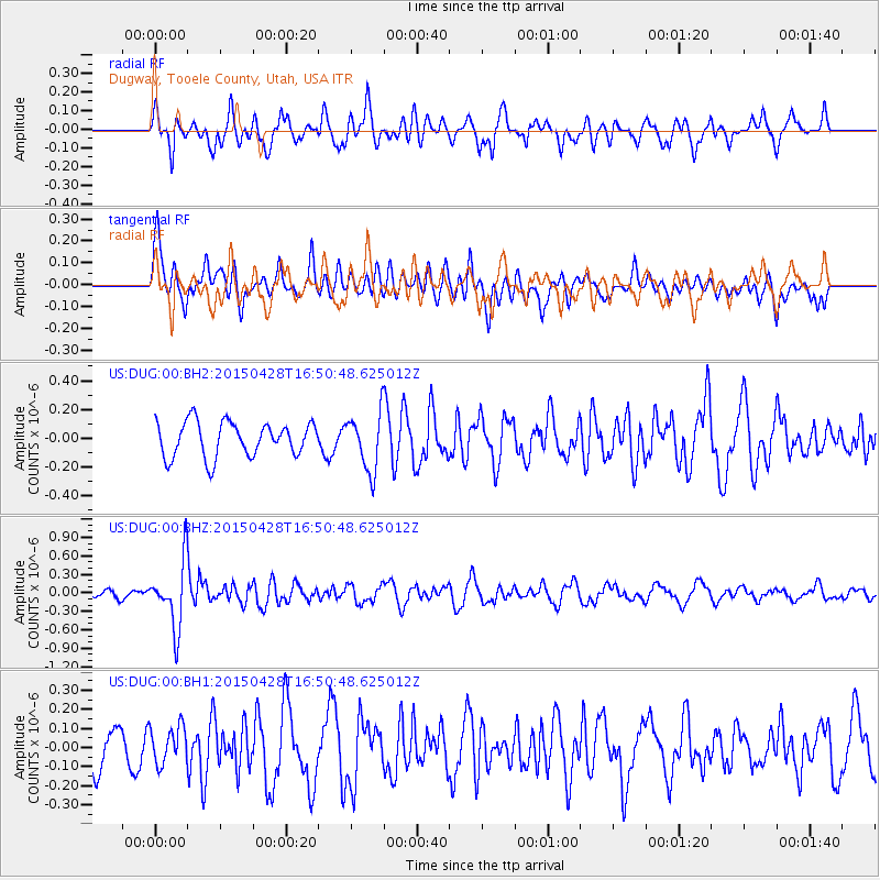
DUG Dugway, Tooele County, Utah, USA - Earthquake Result Viewer
*The percent match for this event was below the threshold and hence no stack was calculated.
| Earthquake location: |
Fiji Islands Region |
| Earthquake latitude/longitude: |
-20.9/-178.7 |
| Earthquake time(UTC): |
2015/04/28 (118) 16:39:38 GMT |
| Earthquake Depth: |
579 km |
| Earthquake Magnitude: |
6.2 MWB |
| Earthquake Catalog/Contributor: |
NEIC PDE/NEIC COMCAT |
|
| Network: |
US United States National Seismic Network |
| Station: |
DUG Dugway, Tooele County, Utah, USA |
| Lat/Lon: |
40.19 N/112.81 W |
| Elevation: |
1477 m |
|
| Distance: |
86.3 deg |
| Az: |
44.458 deg |
| Baz: |
238.741 deg |
| Ray Param: |
$rayparam |
*The percent match for this event was below the threshold and hence was not used in the summary stack. |
|
| Radial Match: |
62.80921 % |
| Radial Bump: |
400 |
| Transverse Match: |
52.093967 % |
| Transverse Bump: |
400 |
| SOD ConfigId: |
872571 |
| Insert Time: |
2015-05-12 16:56:55.626 +0000 |
| GWidth: |
2.5 |
| Max Bumps: |
400 |
| Tol: |
0.001 |
|
Signal To Noise
| Channel | StoN | STA | LTA |
| US:DUG:00:BHZ:20150428T16:50:48.625012Z | 4.9244204 | 5.3392006E-7 | 1.0842293E-7 |
| US:DUG:00:BH1:20150428T16:50:48.625012Z | 0.96271706 | 9.679612E-8 | 1.00544725E-7 |
| US:DUG:00:BH2:20150428T16:50:48.625012Z | 1.6665578 | 1.9930005E-7 | 1.1958784E-7 |
| Arrivals |
| Ps | |
| PpPs | |
| PsPs/PpSs | |


