You are here: Home > Network List > TA - USArray Transportable Network (new EarthScope stations) Stations List
> Station Z41A Richland Creek Farm, El Dorado, AR, USA > Earthquake Result Viewer
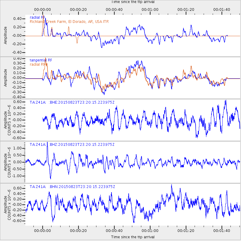
Z41A Richland Creek Farm, El Dorado, AR, USA - Earthquake Result Viewer
*The percent match for this event was below the threshold and hence no stack was calculated.
| Earthquake location: |
Near Coast Of Central Chile |
| Earthquake latitude/longitude: |
-29.7/-71.4 |
| Earthquake time(UTC): |
2015/08/23 (235) 23:10:03 GMT |
| Earthquake Depth: |
34 km |
| Earthquake Magnitude: |
5.5 MB, 5.5 MB |
| Earthquake Catalog/Contributor: |
NEIC PDE/NEIC ALERT |
|
| Network: |
TA USArray Transportable Network (new EarthScope stations) |
| Station: |
Z41A Richland Creek Farm, El Dorado, AR, USA |
| Lat/Lon: |
33.26 N/92.80 W |
| Elevation: |
62 m |
|
| Distance: |
65.8 deg |
| Az: |
340.434 deg |
| Baz: |
159.645 deg |
| Ray Param: |
$rayparam |
*The percent match for this event was below the threshold and hence was not used in the summary stack. |
|
| Radial Match: |
58.04884 % |
| Radial Bump: |
400 |
| Transverse Match: |
52.691685 % |
| Transverse Bump: |
400 |
| SOD ConfigId: |
7422571 |
| Insert Time: |
2019-04-20 13:37:38.130 +0000 |
| GWidth: |
2.5 |
| Max Bumps: |
400 |
| Tol: |
0.001 |
|
Signal To Noise
| Channel | StoN | STA | LTA |
| TA:Z41A: :BHZ:20150823T23:20:15.223975Z | 6.6998515 | 5.4746215E-7 | 8.171257E-8 |
| TA:Z41A: :BHN:20150823T23:20:15.223975Z | 1.8182778 | 2.4798067E-7 | 1.3638216E-7 |
| TA:Z41A: :BHE:20150823T23:20:15.223975Z | 0.5254102 | 7.727136E-8 | 1.4706863E-7 |
| Arrivals |
| Ps | |
| PpPs | |
| PsPs/PpSs | |


