You are here: Home > Network List > US - United States National Seismic Network Stations List
> Station MNTX Cornudas Mountains, Texas, USA > Earthquake Result Viewer
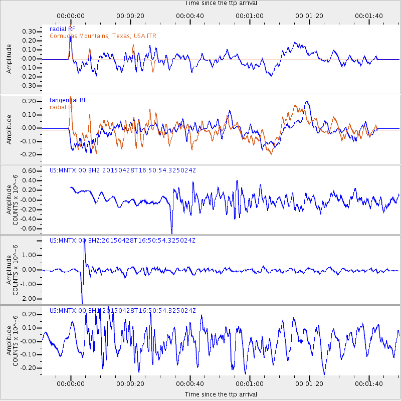
MNTX Cornudas Mountains, Texas, USA - Earthquake Result Viewer
*The percent match for this event was below the threshold and hence no stack was calculated.
| Earthquake location: |
Fiji Islands Region |
| Earthquake latitude/longitude: |
-20.9/-178.7 |
| Earthquake time(UTC): |
2015/04/28 (118) 16:39:38 GMT |
| Earthquake Depth: |
579 km |
| Earthquake Magnitude: |
6.2 MWB |
| Earthquake Catalog/Contributor: |
NEIC PDE/NEIC COMCAT |
|
| Network: |
US United States National Seismic Network |
| Station: |
MNTX Cornudas Mountains, Texas, USA |
| Lat/Lon: |
31.70 N/105.38 W |
| Elevation: |
404 m |
|
| Distance: |
87.5 deg |
| Az: |
54.797 deg |
| Baz: |
243.663 deg |
| Ray Param: |
$rayparam |
*The percent match for this event was below the threshold and hence was not used in the summary stack. |
|
| Radial Match: |
61.95947 % |
| Radial Bump: |
400 |
| Transverse Match: |
38.309814 % |
| Transverse Bump: |
400 |
| SOD ConfigId: |
872571 |
| Insert Time: |
2015-05-12 16:57:51.578 +0000 |
| GWidth: |
2.5 |
| Max Bumps: |
400 |
| Tol: |
0.001 |
|
Signal To Noise
| Channel | StoN | STA | LTA |
| US:MNTX:00:BHZ:20150428T16:50:54.325024Z | 8.226087 | 8.182078E-7 | 9.946502E-8 |
| US:MNTX:00:BH1:20150428T16:50:54.325024Z | 1.0738173 | 1.1720226E-7 | 1.09145454E-7 |
| US:MNTX:00:BH2:20150428T16:50:54.325024Z | 2.1301808 | 2.3525608E-7 | 1.1043949E-7 |
| Arrivals |
| Ps | |
| PpPs | |
| PsPs/PpSs | |


