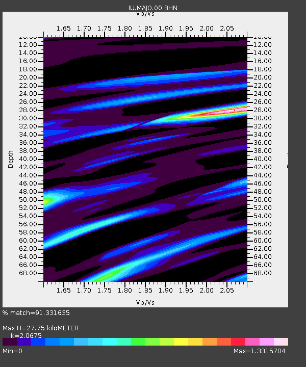
MAJO Matsushiro, Japan - Earthquake Result Viewer
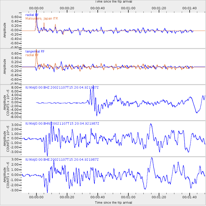
Earthquake location: Rat Islands, Aleutian Islands
Earthquake latitude/longitude: 51.2/179.3
Earthquake time(UTC): 2002/11/07 (311) 15:14:06 GMT
Earthquake Depth: 33 km
Earthquake Magnitude: 5.8 MB, 6.4 MS, 6.6 MW, 6.5 MW
Earthquake Catalog/Contributor: WHDF/NEIC
Network: IU Global Seismograph Network (GSN - IRIS/USGS)
Station: MAJO Matsushiro, Japan
Lat/Lon: 36.54 N/138.21 E
Elevation: 405 m
Distance: 32.6 deg
Az: 259.468 deg
Baz: 50.187 deg
Ray Param: 0.07853373
Estimated Moho Depth: 27.75 km
Estimated Crust Vp/Vs: 2.07
Assumed Crust Vp: 6.461 km/s
Estimated Crust Vs: 3.125 km/s
Estimated Crust Poisson's Ratio: 0.35
Radial Match: 91.331635 %
Radial Bump: 400
Transverse Match: 85.418846 %
Transverse Bump: 400
SOD ConfigId: 4714
Insert Time: 2010-03-04 16:03:24.807 +0000
GWidth: 2.5
Max Bumps: 400
Tol: 0.001

Signal To Noise

ChannelStoNSTALTA
IU:MAJO:00:BHN:20021107T15:20:04.921987Z1.81446842.3258877E-71.2818563E-7
IU:MAJO:00:BHE:20021107T15:20:04.921987Z1.6701411.8714174E-71.1205146E-7
IU:MAJO:00:BHZ:20021107T15:20:04.921987Z3.78797325.412022E-71.4287382E-7
Arrivals
Ps4.9 SECOND
PpPs12 SECOND
PsPs/PpSs17 SECOND