MAJO Matsushiro, Japan - Earthquake Result Viewer
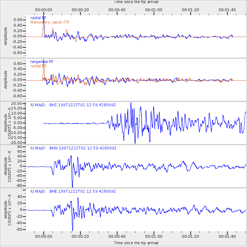
Earthquake location: Eastern New Guinea Reg., P.N.G.
Earthquake latitude/longitude: -5.5/147.9
Earthquake time(UTC): 1997/12/22 (356) 02:05:50 GMT
Earthquake Depth: 179 km
Earthquake Magnitude: 6.3 MB, 6.7 MS, 7.1 UNKNOWN, 7.0 ME
Earthquake Catalog/Contributor: WHDF/NEIC
Network: IU Global Seismograph Network (GSN - IRIS/USGS)
Station: MAJO Matsushiro, Japan
Lat/Lon: 36.54 N/138.21 E
Elevation: 405 m
Distance: 42.8 deg
Az: 348.525 deg
Baz: 165.764 deg
Ray Param: 0.072269864
Estimated Moho Depth: 49.75 km
Estimated Crust Vp/Vs: 1.63
Assumed Crust Vp: 6.461 km/s
Estimated Crust Vs: 3.952 km/s
Estimated Crust Poisson's Ratio: 0.20
Radial Match: 94.68764 %
Radial Bump: 400
Transverse Match: 92.159035 %
Transverse Bump: 400
SOD ConfigId: 4480
Insert Time: 2010-03-04 16:03:55.761 +0000
GWidth: 2.5
Max Bumps: 400
Tol: 0.001

Signal To Noise

ChannelStoNSTALTA
IU:MAJO: :BHN:19971222T02:12:59.428009Z18.7001194.4536782E-62.3816311E-7
IU:MAJO: :BHE:19971222T02:12:59.428009Z9.4978642.2429406E-62.3615212E-7
IU:MAJO: :BHZ:19971222T02:12:59.428009Z2.41417814.6769472E-71.9372835E-7
Arrivals
Ps5.3 SECOND
PpPs19 SECOND
PsPs/PpSs24 SECOND