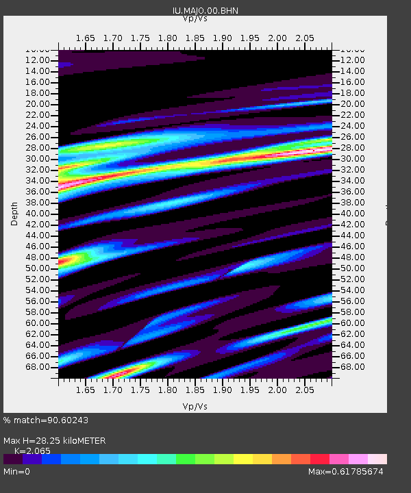
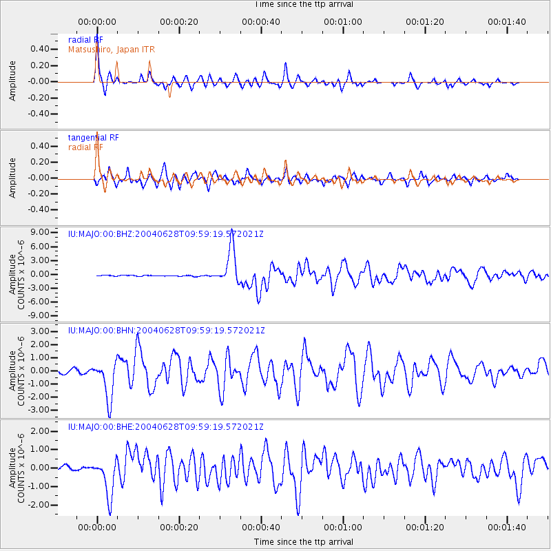
MAJO Matsushiro, Japan - Earthquake Result Viewer

Earthquake location: Queen Charlotte Islands Region
Earthquake latitude/longitude: 54.8/-134.2
Earthquake time(UTC): 2004/06/28 (180) 09:49:47 GMT
Earthquake Depth: 20 km
Earthquake Magnitude: 5.9 MB, 6.8 MS, 6.8 MW, 6.8 MW
Earthquake Catalog/Contributor: WHDF/NEIC
Network: IU Global Seismograph Network (GSN - IRIS/USGS)
Station: MAJO Matsushiro, Japan
Lat/Lon: 36.54 N/138.21 E
Elevation: 405 m
Distance: 59.8 deg
Az: 291.388 deg
Baz: 42.027 deg
Ray Param: 0.061941832
Estimated Moho Depth: 28.25 km
Estimated Crust Vp/Vs: 2.07
Assumed Crust Vp: 6.461 km/s
Estimated Crust Vs: 3.129 km/s
Estimated Crust Poisson's Ratio: 0.35
Radial Match: 90.60243 %
Radial Bump: 260
Transverse Match: 87.58382 %
Transverse Bump: 348
SOD ConfigId: 2459
Insert Time: 2010-03-04 16:04:00.981 +0000
GWidth: 2.5
Max Bumps: 400
Tol: 0.001

Signal To Noise

ChannelStoNSTALTA
IU:MAJO:00:BHN:20040628T09:59:19.572021Z10.5875981.5291881E-61.4443202E-7
IU:MAJO:00:BHE:20040628T09:59:19.572021Z10.0296151.0672105E-61.0640593E-7
IU:MAJO:00:BHZ:20040628T09:59:19.572021Z42.2480134.175022E-69.882174E-8
Arrivals
Ps4.9 SECOND
PpPs13 SECOND
PsPs/PpSs18 SECOND