You are here: Home > Network List > TA - USArray Transportable Network (new EarthScope stations) Stations List
> Station H17A Grant Village (NPS), Yellowstone Nt. Park, WY, USA > Earthquake Result Viewer
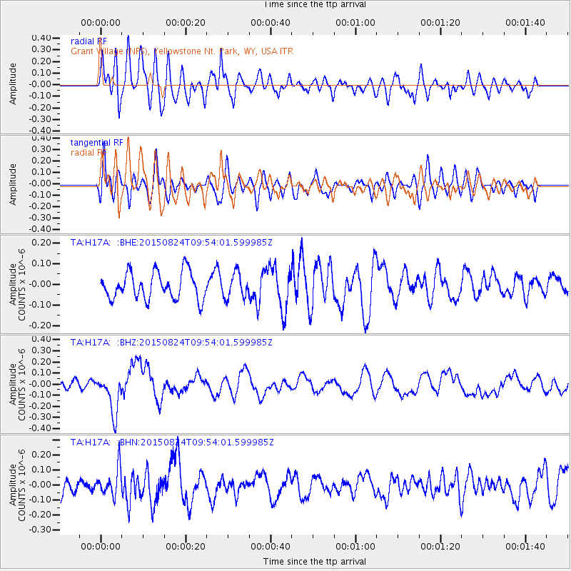
H17A Grant Village (NPS), Yellowstone Nt. Park, WY, USA - Earthquake Result Viewer
*The percent match for this event was below the threshold and hence no stack was calculated.
| Earthquake location: |
Kermadec Islands Region |
| Earthquake latitude/longitude: |
-30.6/-179.1 |
| Earthquake time(UTC): |
2015/08/24 (236) 09:41:25 GMT |
| Earthquake Depth: |
224 km |
| Earthquake Magnitude: |
6.0 MW |
| Earthquake Catalog/Contributor: |
ISC/ISC |
|
| Network: |
TA USArray Transportable Network (new EarthScope stations) |
| Station: |
H17A Grant Village (NPS), Yellowstone Nt. Park, WY, USA |
| Lat/Lon: |
44.40 N/110.58 W |
| Elevation: |
2400 m |
|
| Distance: |
97.3 deg |
| Az: |
42.266 deg |
| Baz: |
233.953 deg |
| Ray Param: |
$rayparam |
*The percent match for this event was below the threshold and hence was not used in the summary stack. |
|
| Radial Match: |
50.74417 % |
| Radial Bump: |
400 |
| Transverse Match: |
49.183342 % |
| Transverse Bump: |
400 |
| SOD ConfigId: |
7422571 |
| Insert Time: |
2019-04-20 13:46:25.386 +0000 |
| GWidth: |
2.5 |
| Max Bumps: |
400 |
| Tol: |
0.001 |
|
Signal To Noise
| Channel | StoN | STA | LTA |
| TA:H17A: :BHZ:20150824T09:54:01.599985Z | 4.615617 | 1.805115E-7 | 3.9108862E-8 |
| TA:H17A: :BHN:20150824T09:54:01.599985Z | 1.4554454 | 9.2517666E-8 | 6.356657E-8 |
| TA:H17A: :BHE:20150824T09:54:01.599985Z | 0.9490823 | 6.160582E-8 | 6.491093E-8 |
| Arrivals |
| Ps | |
| PpPs | |
| PsPs/PpSs | |


