You are here: Home > Network List > WY - Yellowstone Wyoming Seismic Network Stations List
> Station YHH Holmes Hill, YNP, WY, USA > Earthquake Result Viewer
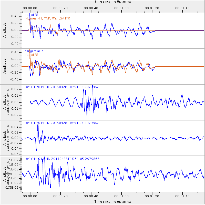
YHH Holmes Hill, YNP, WY, USA - Earthquake Result Viewer
*The percent match for this event was below the threshold and hence no stack was calculated.
| Earthquake location: |
Fiji Islands Region |
| Earthquake latitude/longitude: |
-20.9/-178.7 |
| Earthquake time(UTC): |
2015/04/28 (118) 16:39:38 GMT |
| Earthquake Depth: |
579 km |
| Earthquake Magnitude: |
6.2 MWB |
| Earthquake Catalog/Contributor: |
NEIC PDE/NEIC COMCAT |
|
| Network: |
WY Yellowstone Wyoming Seismic Network |
| Station: |
YHH Holmes Hill, YNP, WY, USA |
| Lat/Lon: |
44.79 N/110.85 W |
| Elevation: |
2717 m |
|
| Distance: |
89.9 deg |
| Az: |
41.248 deg |
| Baz: |
239.955 deg |
| Ray Param: |
$rayparam |
*The percent match for this event was below the threshold and hence was not used in the summary stack. |
|
| Radial Match: |
70.23595 % |
| Radial Bump: |
368 |
| Transverse Match: |
59.161118 % |
| Transverse Bump: |
400 |
| SOD ConfigId: |
872571 |
| Insert Time: |
2015-05-12 17:01:50.466 +0000 |
| GWidth: |
2.5 |
| Max Bumps: |
400 |
| Tol: |
0.001 |
|
Signal To Noise
| Channel | StoN | STA | LTA |
| WY:YHH:01:HHZ:20150428T16:51:05.297986Z | 4.5847893 | 1.3872351E-8 | 3.0257337E-9 |
| WY:YHH:01:HHN:20150428T16:51:05.297986Z | 0.79713625 | 2.5457478E-9 | 3.193617E-9 |
| WY:YHH:01:HHE:20150428T16:51:05.297986Z | 1.7957876 | 5.9561263E-9 | 3.316721E-9 |
| Arrivals |
| Ps | |
| PpPs | |
| PsPs/PpSs | |


